


Dry and seasonably cool weather will continue for the Triad tonight and Sunday. However, clouds will begin to increase for our region by late Sunday as an approaching rain storm eyes the Carolinas for early this work week.
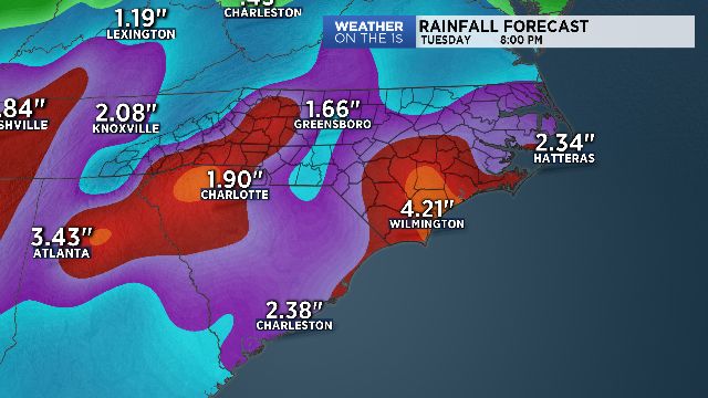
Areas of rain are scheduled to begin morning Monday and then continue at times through at least Tuesday. Heavier periods of rain will be most likely Monday night through early Tuesday. This is when we'll have a risk of flooding, mainly for the Foothills and High Country.
Nonetheless, aninch or two of rain will be possible during this time and that could lead to flooding of roadways along with small creeks and streams.
Clouds and lingering lighter rain are set for Wednesday. After that, drier and pleasant weather appears likely for Thursday & Friday.
Get the latest news, sports and weather delivered straight to your inbox. Click here to sign up for email and text alerts.