


Wednesday was an extremely warm day around the region with highs 80 or better across most of the region. In fact, down in South Carolina, Columbia even hit 88 and Charleston hit 87. Every observing site in our viewing area made it to at least 80.
A cold front slipped into the region early today, and temperatures will be steady or falling for much of the day as a cooler airmass arrives. Winds will be gusty out of the northwest, and once again, the fire danger is elevated today with low humidity, dry ground conditions, and gusty winds.
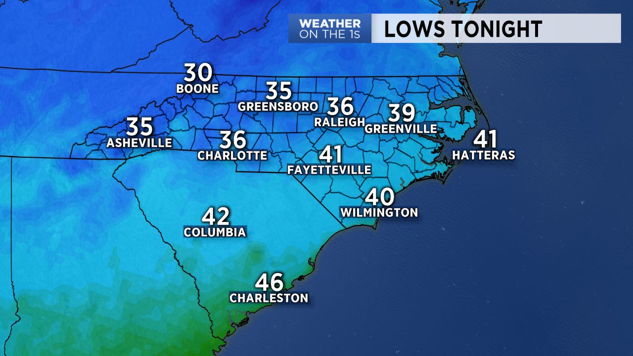
Tonight will be chilly with most lows well down into the 30s. Temperatures will likely be cold enough for some patchy frost in some areas, so be aware of that if you have plants in the ground.
Below average temps will now be here to stay for a while. In fact, there's a good chance that every high temperature between now and the end of next week will be below the late April averages.
Look for highs in the 60s tomorrow through the weekend with a good amounts of sunshine. Then our next system will approach and very slowly move through early next week. That system will deliver some good rain chances, especially late Monday, Tuesday and lingering into Wednesday.
Get the latest news, sports and weather delivered straight to your inbox. Click here to sign up for email and text alerts.