


All last week, we had been highlighting the potential for strong to severe storms Sunday. As I mentioned, the devil is in the small-scale meteorological details when dealing with severe weather threats, and unfortunately, those details that set up Sunday tipped the scales in favor of an outbreak of severe weather.
We had a warm and unstable airmass in place, and the timing of the arrival of the system was such that the storms arrived at the warmest part of the day. Highs made it into the upper 70s and lower 80s in many piedmont locations.
This allowed a morning line of storms over western South Carolina to steadily strengthen as it moved into the piedmont of North Carolina. This was a classic scenario of an intense line of storms with embedded tornadic circulations spinning up within the individual storms in the line. For instance, the storm that caused the tornado in the greater Greensboro area also caused tornado warnings to be issued near Columbia, SC earlier in the afternoon.
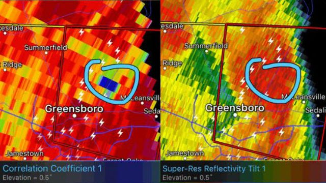
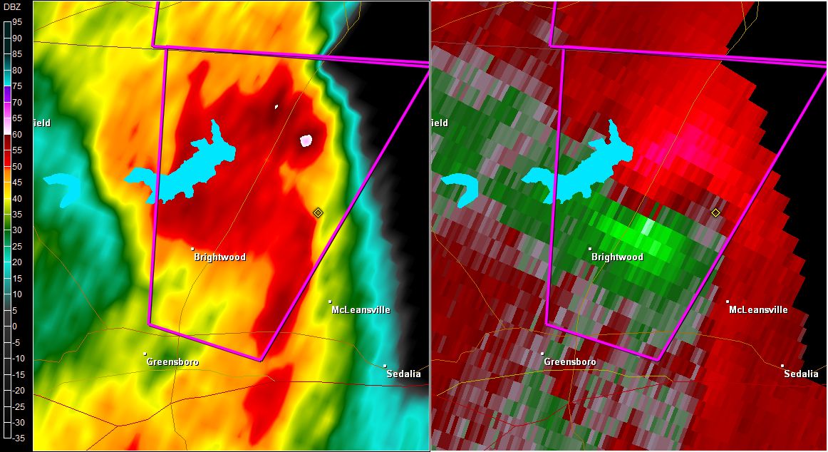
As for the Greensboro tornado, the circulation tightened right as the storm moved from Randolph County into Guilford County. Above and below are a couple of radar images from that tornado. Below on the image on the left, it just has the appearance of a line of intense storms. But when you look at the winds inside that line of storms (image below to the right), an intense radar couplet is evident. The red shades indicate wind moving away from the Raleigh radar site and the green indicates wind moving toward the radar site.
Finally, if you look at the image above on the left, that is a newer radar product called correlation coefficient. Without getting too technical, what that product shows you are how uniform in size objects the radar beam is hitting are. If you notice the little hole, or area of lower values, over eastern Greensboro, that is where the radar is picking up on lots of irregularly-shaped objects. In this case, the radar is picking up on debris from the tornado being lofted high into the air. This is what is called a Tornado Debris Signature, and when this feature is evident, it is almost always a sure-fire sign you have a tornado on the ground.
Get the latest news, sports and weather delivered straight to your inbox. Click here to sign up for email and text alerts.