


We have one more cool day today before a much warmer setup arrives for a little while. Look for lots of clouds through our Tuesday, and highs will struggle to make it to near 50 this afternoon. Lows will then drop into the 40s tonight.
A few sprinkles will remain possible today, but there will not be any measurable rain.
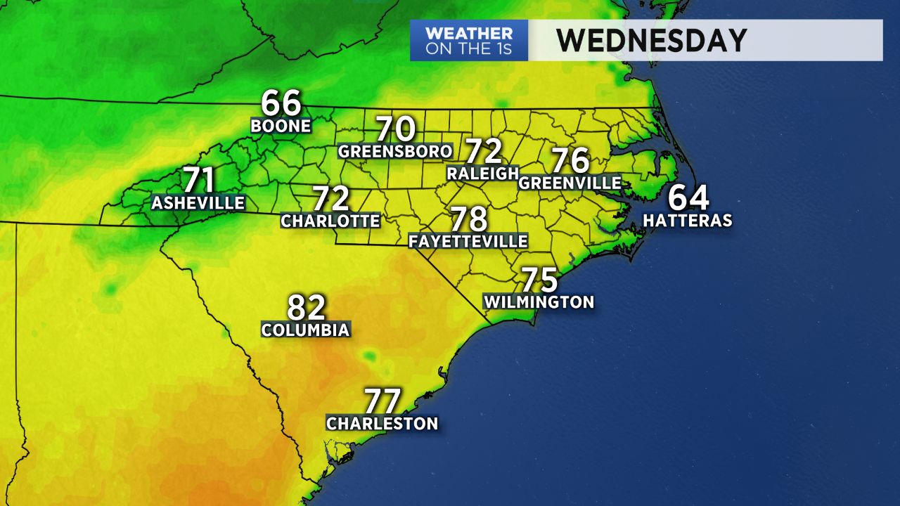
Much warmer air returns to the region tomorrow. Look for highs to make it to near 70, and then I expect mid and upper 70s Thursday afternoon -- much, much warmer!
Our next cold front arrives Thursday night, and some showers will be a possibility at that time. In fact, the shower chances could linger into much of Friday as well. However, the remainder of Easter weekend looks great with lots of sun and highs well into the 60s, maybe even 70 Easter Sunday.
Enjoy the warmth while it lasts. A cooler pattern will likely return next week.