


First of all, we get to enjoy great Friday weather with lots of sun and cool temperatures. Piedmont highs will be in the 50s to near 60 degrees with mountain highs generally in the lower 40s.
Our next storm system, which began Friday over the Plains states, will spread precipitation into the mountain areas by daybreak Saturday.
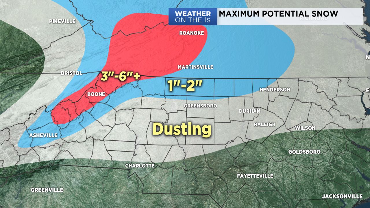
For the northern mountains, most of this precipitation Saturday morning into the afternoon will be in the form of snow, and 3-6" are possible. Thereafter, as temperatures aloft warm a bit, many areas in Avery, Watauga, and Ashe counties could switch over to freezing rain, and I am growing more concerned about significant ice accumulation in those areas on top of the already-fallen snow.
For the foothills and piedmont, as the precipitation arrives Saturday morning, a period of sleet or snow will be possible, but as the day unfolds, the rain/snow line should retreat northward to near or just north of I-40. So for that Charlotte area, most of this event should be in the form of a very chilly rain. The snow could linger longer around the Triad.
For areas near and north of I-40, the snow will likely hang on longer, and there could be some slushy snow accumulations, primarily on the grassy and elevated surfaces, by later Saturday afternoon and Saturday night.
This is a very complicated forecast, and some forecast changes are likely.
Get the latest news, sports and weather delivered straight to your inbox. Click here to sign up for email and text alerts.