


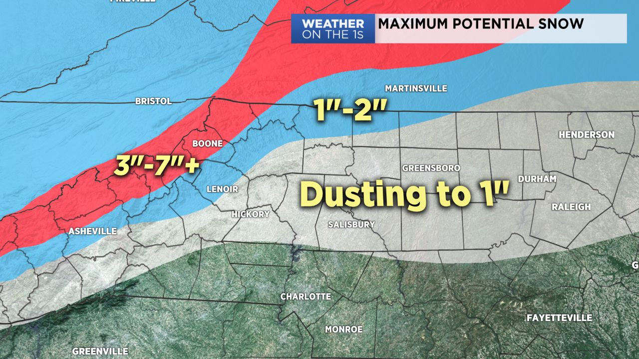
As an area of low pressure slowly pulls up the East Coast, snow showers continue for parts of our region through the morning hours. A slushy inch or so of accumulation is possible on the grassy and elevated surfaces, but many areas will likely receive no snow accumulation. Up in the mountains, 3-7" are likely through Thursday.
As temperatures warm above freezing today, some lingering rain showers are possible this afternoon in our area with highs in the 40s. Lows drop to near 30 tonight.
Thursday and Friday look good with sunshine and highs in the 50s.
Our next system will then arrive this weekend. At this point, I am expecting rain for Saturday, and then as temperatures cool, some snow could again be involved in some areas Saturday night into Sunday.