


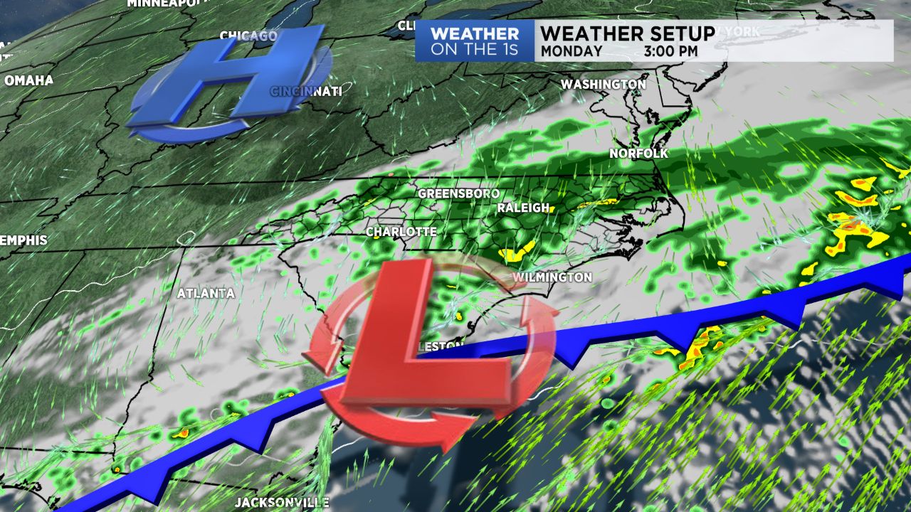
An area of low pressure began Monday in Alabama and will head off the South Carolina coast this evening. That storm system will provide the region with rain more often than not through the day. This will not be a heavy rain event with 0.5" probably being the upper limit of total rain potential. In fact, most spots will be doing well to pick up a quarter or a third of an inch.
Temperatures will hold steady or slowly fall through the day as well as a cooler airmass takes hold around the region. Our sky will quickly clear this evening, and that clear sky will allow for lows to drop into the mid to upper 30s for most of the area.
Our Tuesday features full sunshine with highs in the lower 60s. Soak up the sun because our next storm system will roll in later Wednesday.
Rain will spread back into the region later Wednesday into Wednesday night. Then on Thursday, the core of the system will move through, and that is when our heaviest rain is most likely to occur.
Many folks have been wanting a dry weekend, and we can deliver on that for the upcoming weekend. Friday will likely see some snow fall in the mountains while the rest of the region has a sunny and breezy day. The entire region then should see full sun through the weekend with our local highs generally in the 50s and lows in the 30s.
Be sure and check out today's video for much more.
Follow Matthew East on Twitter and Facebook.
Get the latest news, sports and weather delivered straight to your inbox. Click here to sign up for email and text alerts.