


Many record highs were toppled yesterday around the region, including Greensboro. The PTI Airport hit 78 degrees, easily breaking the old record of 74. Burlington hit 80 as did Charlotte and many areas in the eastern Carolinas were 80 or better.
Another day or record warmth is unfolding today. Today's record in Greensboro is 74, and we have a very good chance of breaking that one as well.
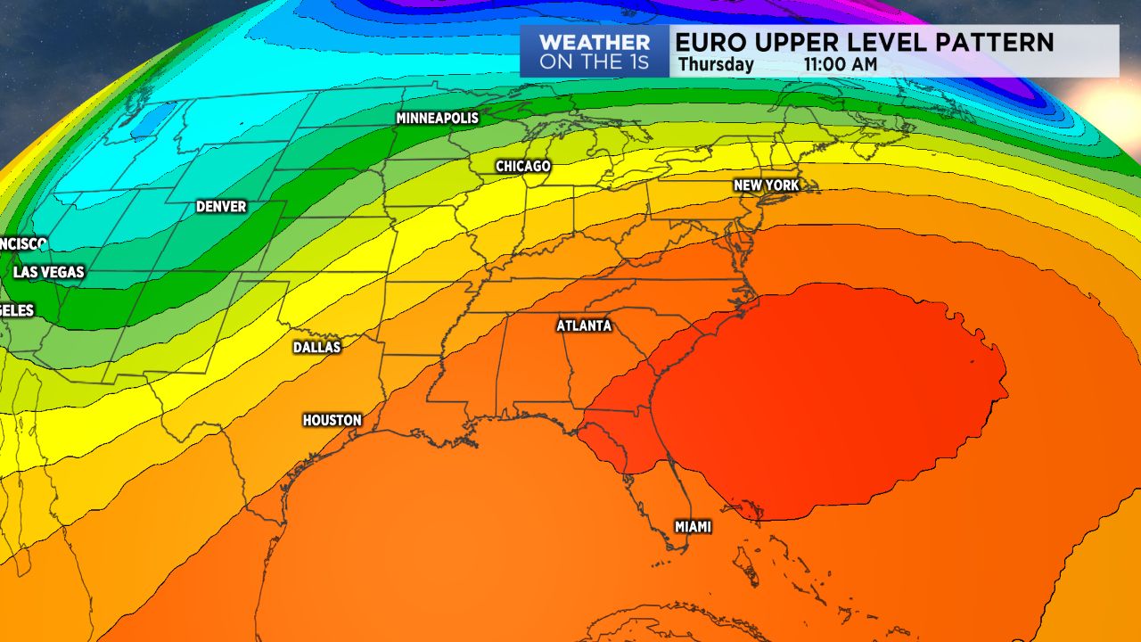
The reason for the warmth? A summer pattern, February style. A massive upper level ridge is centered just off the Southeast coast and that is pumping the warm air through the Carolinas.
This ridge has also kept a frontal boundary parked from the Ohio Valley down through the Lower Mississippi Valley, and multiple waves of rain, snow, and ice have impacted those areas.
The ridge will relax a bit this weekend, allowing the front to drop into our area. So I expect a slightly better shower chance Saturday with good shower chances Sunday, lingering into Monday.
Beyond, next week looks cooler, but certainly not cold. Temperatures still look a bit above average, but we should shy away from the record high temperature values.
Get the latest news, sports and weather delivered straight to your inbox. Click here to sign up for email and text alerts.