


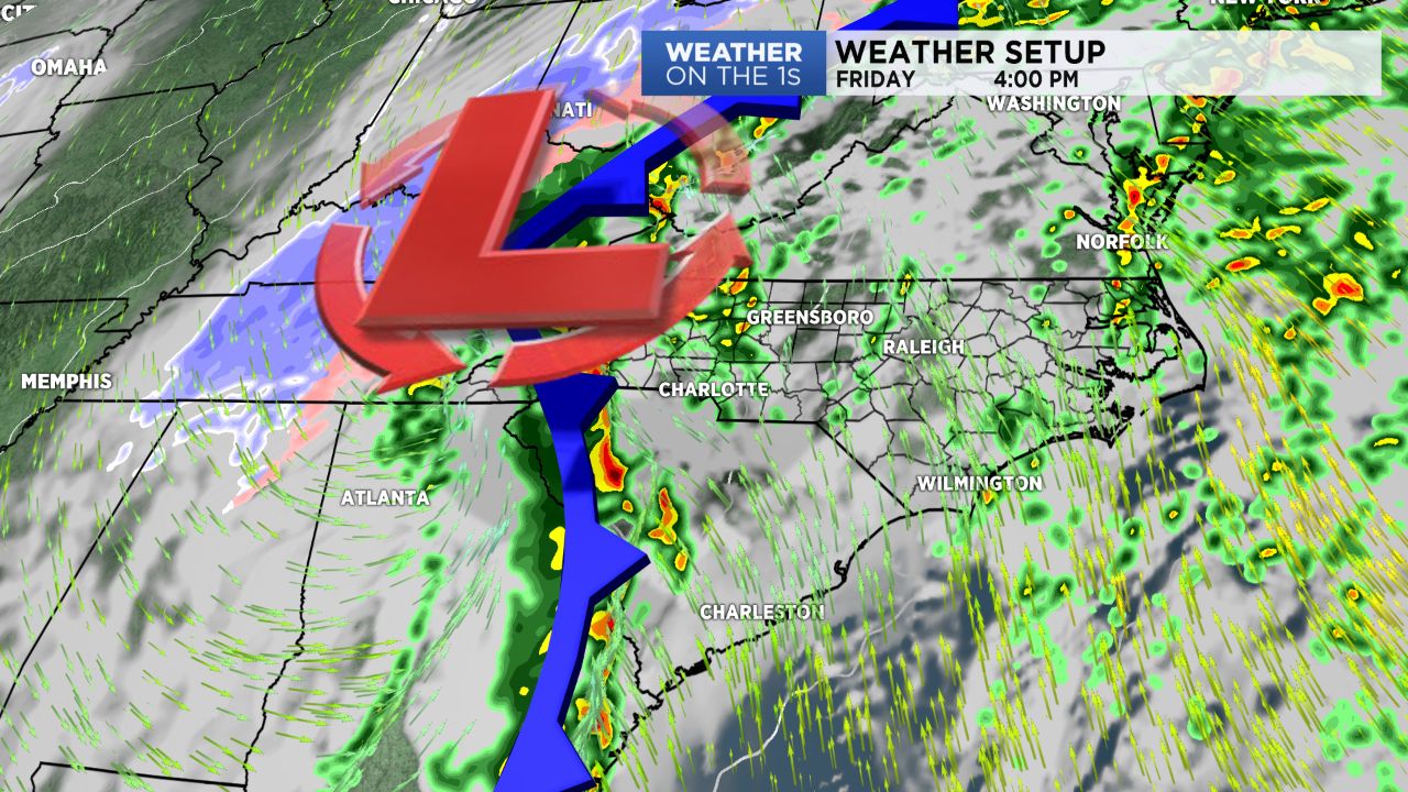
A dynamic January storm system is moving through the Tennessee Valley today and into the Northeast by Saturday. We are on the warm side of that system today, so we will have very mild conditions, a blustery southerly wind, and showers and storms. As we head into late afternoon and evening, a band of showers and embedded storms will likely move through, and I can't rule out the potential for a damaging wind gust or two.
On the cold side of this system, wintry precip is occurring this morning from northern Louisiana into Arkansas, northwest Mississippi, western Tennessee, and points northeast from there. Much colder air will flow into the Carolinas starting late tonight, and some snow will fly in the mountains tonight into Saturday morning.
Our big weekend weather story will be the return of cold air. By Sunday, highs will be in the 30s, and lows will likely dip toward the upper teens early next week. Another blast of cold air arrives midweek as well. I am keeping an eye on a potential storm system around Wednesday, but as of this morning's forecast package, I have left precipitation chances very low.