


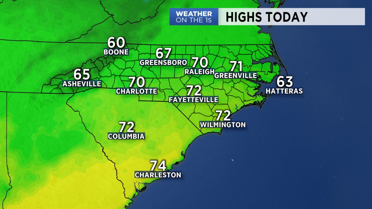
Beautiful weather is unfolding for our Wednesday with highs in the mid to upper 60s under a sunny sky. Keep in mind, our average high this time of year is 56 degrees, so we are a good bit above that today.
Thursday looks nice as well with sunshine and highs in the lower 60s, and then a cold front quickly drop through Thursday night. As that frontal passage occurs, a few brief showers are possible during the overnight hours Thursday night into Friday morning, but this looks rather insignificant.
Friday will be relatively mild and quiet, and then look for a good deal of clouds Saturday with highs in the 50s. Rain chances now look very slim Saturday.
Next week, a fundamental pattern change will occur across North America. A ridge will go up over western North America, and the result will be a large trough in the eastern US. Unlike our previous intrusions of chilly air, this pattern will attempt to lock in for a while....at least mid-December. So look for lots of colder weather starting roughly the middle of next week.
For more on all of this, please check out today's video.