


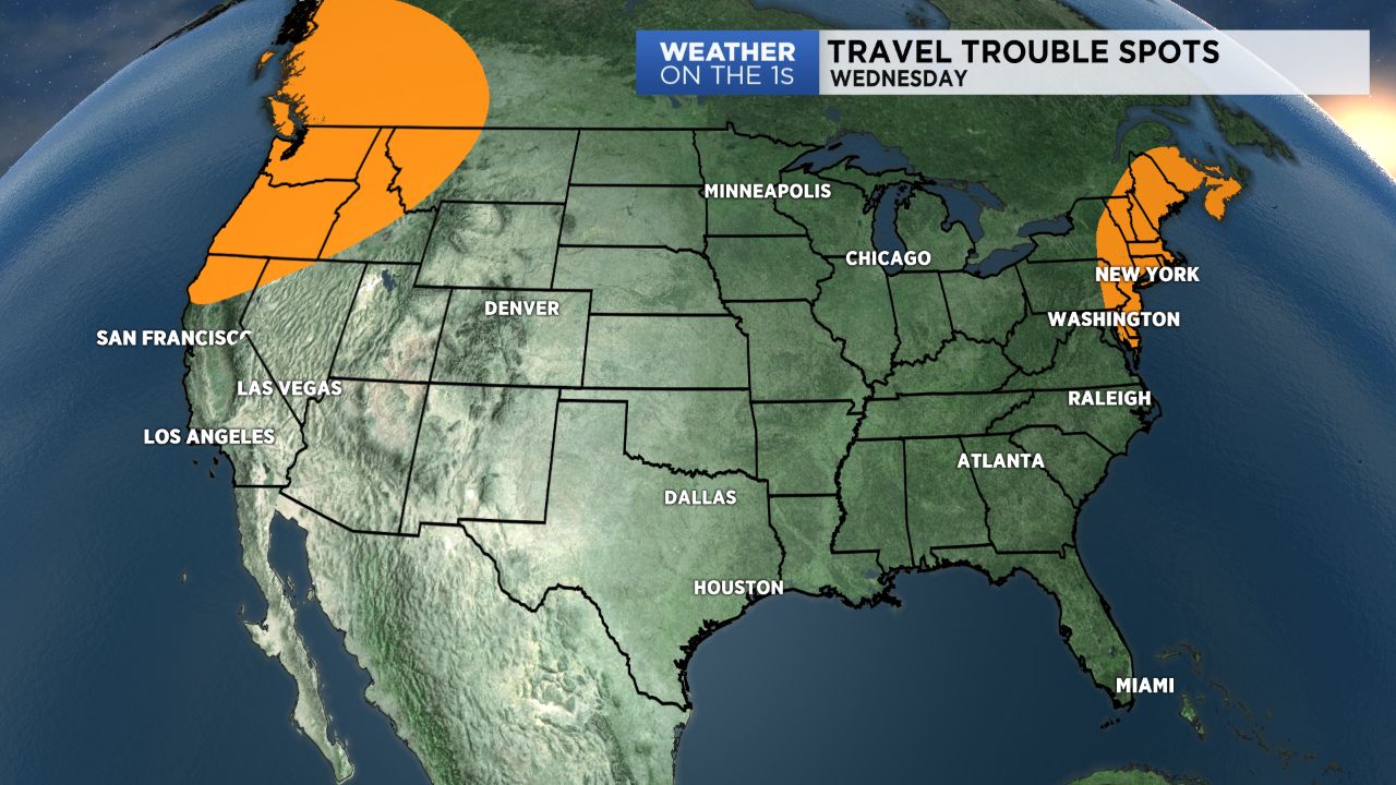
As we approach the huge travel day Wednesday, I thought we would take a look at where you could hit some weather-related travel trouble spots.
There are two main areas of the Lower 48 where the weather could cause some widespread delays. First of all is the Northeast U.S. as a system quickly clips through that region, and some showers and interior Northeast snow will taper off during the first half of Wednesday.
Secondly, the Pacific Northwest into parts of Idaho and Montana will be impacted by a system moving in from the Pacific. This will cause some rain and mountain snow through much of Wednesday and Wednesday night in those areas.
Otherwise, aside from some snow showers in North Dakota and Minnesota and a few showers popping up in Florida, I expect no other major weather delays.
It will be a chilly day through the Great Lakes, Ohio Valley, and Tennessee Valley regions with lots of 30s and 40s for highs. Conversely, highs in the Desert Southwest could push 90 in some areas.
The Carolinas look quiet Wednesday with highs a little milder than what we've seen of late.