


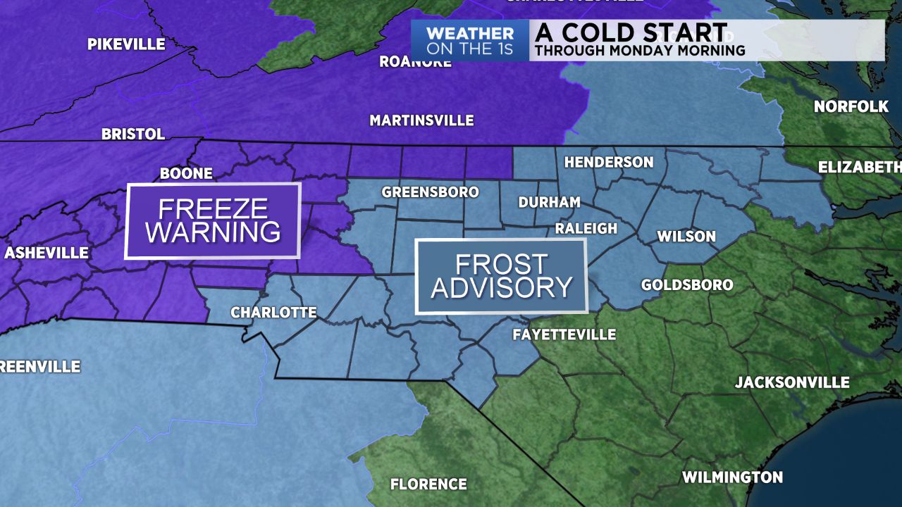
Many of us will wake up Monday morning to frosty conditions. As high pressure settles in over the region we’ll see clear skies and light winds overnight allowing for temperatures to really drop. Because of this, a frost advisory is in effect for much of central North Carolina, including the Triad and the Triangle. North and west of the Triad, a freeze warning has been issued.
Low temperatures will drop to the low to mid-30s in the Triad, mid-30s in the Triangle and upper 30s in the Sandhills.
Monday afternoon highs will climb to the 50s and 60s. We'll be warmer for Tuesday with the help of ample sunshine and a southerly breeze.
A cold front will cool us down for Wednesday, and then the chance of rain increases as we head into the end of the workweek and into the weekend.