


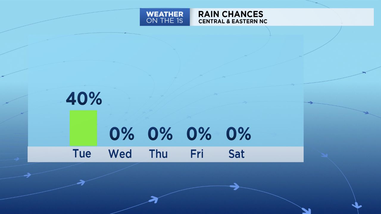
North Carolina will finally get to say goodbye and good riddance to Florence by Tuesday night. What's left of the system will be passing well north of the state Tuesday across parts of Pennsylvania. That may seem far away, but it is still close enough that isolated showers and storms will pop up at times.
Most of the isolated storms Tuesday morning will be found east of I-95 and near the coast. By afternoon, any location across central and eastern North Carolina could then see an isolated storm. Some of the storms will produce locally heavy downpours, lightning, and gusty winds.
In most cases, the downpours will be brief. However, the downpours could instantly increase the threat for flash flooding particularly across southeastern North Carolina where 20-35 inches of rain has fallen since Thursday.
In between of the of the storms, much of the day will be partly sunny and quite warm. Highs will top out in the mid and upper 80s.
Tuesday will be the last day for any rain chances this week. A period of sunny and dry weather is forecast from Wednesday through at least the first half of the upcoming weekend.