


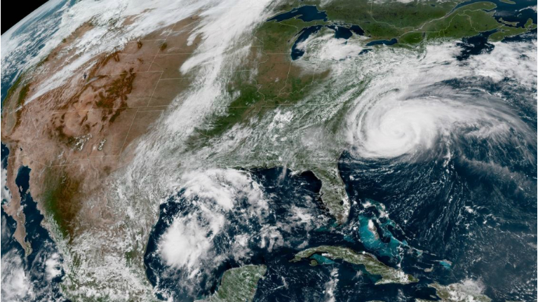
Hurricane Florence has continued to grow in size as it approaches the Carolina coast. The storm may have weakened to a category 2 hurricane late Wednesday, but the monster storm is still forecast to bring devastating impacts to the Carolinas. Additionally, a tornado watch has been issued for parts of eastern North Carolina.
- Watch Spectrum News LIVE on your desktop, laptop or mobile device for storm coverage. For public safety, our live streams will be available to all residents of North Carolina.
The initial rain bands of the storm will reach the coast Thursday morning where wind gusts will increase to between 40 and 70mph by late afternoon and evening. The rain will also become heavier and more steady by the afternoon or evening.
Farther inland across central North Carolina, much of Thursday will be mostly cloudy. Spotty showers with downpours will be possible at times in the afternoon. Wind gusts will reach between 20 and 40mph by afternoon with gusts over 40mph possible by late Thursday night and Friday morning.
Weather conditions around the region will deteriorate into the day Friday as Florence slowly comes inland over southeastern North Carolina or near the North Carolina-South Carolina border.
Tornadoes
As the first rain bands from Florence arrive at the coast today, brief tornadoes could spin up. The tornado threat will then continue through Friday and possibly Saturday in some locations. The greatest risk of tornadoes will be near and to the right of the storm's eye.
Storm surge
A prolonged period of hurricane force blowing water from the Atlantic toward shore will create a life-threatening storm surge for much of the North Carolina coast that could last through several tide cycles. The highest surge is forecast from the Cape Fear to Cape Lookout where the surge could be as high as 9 to 12 feet above ground level. A similar surge is possible along the Neuse, Pamlico, Pungo and Bay Rivers.
Destructive winds
Hurricane force winds are possible along and just inland from the southeast coast of North Carolina from Thursday night through late Friday night. During that time 70 to 110mph winds are expected. Farther inland closer to the Triangle and Sandhills 35 to 55mph gusts are likely from Thursday night through Saturday. Inland winds could lead to spotty power outages, but more extended outages lasting possibly for weeks are expected at the coast.
Flooding rain
Devastating flooding appears likely for southeastern North Carolina. At least 20 to 30 inches of rain is forecast in southeastern North Carolina including locations near Wilmington and Jacksonville. Localized higher amounts of up to 40 inches are possible. For locations from Fayetteville and Lumberton to Goldsboro, 10 to 15 inches are forecast. The Raleigh and Durham area to Wilson should see between 5 and 10 inches. Much of this rain will fall from Thursday night into early next week.
The Piedmont to the mountains will also eventually see heavy rains from Florence. Locations from Greensboro and Charlotte to the mountains can expected as much as 5 to 10 inches. Most of the rain for the western half of the state will come from Sunday through the first half of next week.
Stay up to date on the clean-up and aftermath of Florence:
- Florence resources and helpful links
- How to begin the steps to recovery
- Residents return after Florence
- Like us on Facebook
- Watch Live
- Closings and delays
- Download the App