


Wilmington is experiencing its second wettest year on record. Rain that is on the way over the next several days will likely make 2018 the wettest year on record to date.
- Interactive radar
- 7-day forecast
- Share your weather reports and photos with Meteorologist Lee Ringer on Facebook
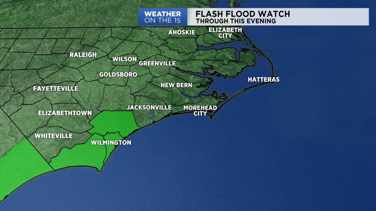
Two to three inches of rain could fall in southeastern North Carolina from Friday morning to Friday night. For that reason, the National Weather Service has issued a Flash Flood Watch through Friday night for locations in and around Wilmington including New Hanover, Brunswick, and Pender Counties.
Drivers should watch for the possibility of flooding roads during the heaviest downpours. If you encounter a road covered by water, turn around and find another route. It can be difficult to determine just how deep the water may be. What seems like just a small amount of flowing water could still be enough to float your car, truck, or SUV off the road.
Low pressure is forming Friday morning near Charleston, South Carolina. That low will slowly track up the coast of North Carolina from late Friday through early Saturday morning. Showers and storms will building into the southeastern part of the state ahead of that low Friday morning and continue off and on through the day. Northeastern North Carolina will see higher rain chances for Friday night through early Saturday morning.
This is just the start of a wet weather pattern that will last through all of next week. Scattered afternoon and evening thunderstorms are expected in the area every day this weekend through at least the end of next week.
Most of North Carolina will see at least three to six inches of rain through next Friday.
Get the latest news, sports and weather delivered straight to your inbox. Click here to sign up for email and text alerts.