


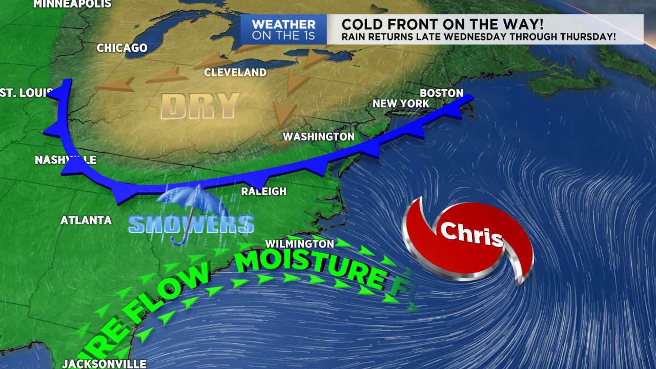
NORTH CAROLINA -- One more dry day and then we need to have the umbrellas close by. A cold front is on the way that will provide our next good shot of rain for much of the state beginning late Wednesday.
- Temperatures are racing into the low 90s this afternoon
- Expect a sunny start tomorrow with quickly warming temperatures
- Expect isolated showers initially, then becoming scattered Wednesday night into Thursday
Until then we’re going to bask in the sunshine as we move through a warmer day than yesterday. After highs in the mid to upper 80s Monday, temperatures are racing into the low 90s this afternoon.
With such beautiful weather you may forget we have a growing tropical system just offshore. Tropical Storm Chris continues to become more organized.
The center of circulation was last located about 200 miles southeast of Cape Hatteras. It wouldn’t be too surprising if it was upgraded to a category 1 hurricane before the day was over. The good news is Chris is moving northeast away from the U.S. and will move over the northern Atlantic over the coming days.
So Chris is no concern to us, but a cold front currently diving southeast across the Ohio River Valley is a concern. Our run of dry, fair weather will end Wednesday.
Expect a sunny start tomorrow with quickly warming temperatures. Clouds will grow overhead as we move through the day.
Temperatures will peak in the low to mid 90s during the afternoon when rain will likely begin for a few areas. Expect isolated showers initially, then becoming scattered Wednesday night into Thursday.
Scattered showers will be an issue mainly for south and southeastern North Carolina late Thursday through Friday morning.
Thankfully we’ll have dry weather for all by Friday night and through the day Saturday. Temperatures will be near normal behind the cold front ranging from the upper 80s to low 90s.