


NORTH CAROLINA -- The fair weather we closed out the weekend with followed us into the work week.
- After a cool morning that started in the 50s for some locations, we’ll remain below average for most in the mid-60s
- Expect highs in the low 90s Tuesday afternoon and low to mid 90s Wednesday
- Clouds will take up more of the sky Wednesday as a cold front begins to move through the area
Sunny skies dominate most of the state as extreme eastern locations deal with partly cloudy skies. After a cool morning that started in the 50s for some locations, we’ll remain below average for most in the mid-60s.
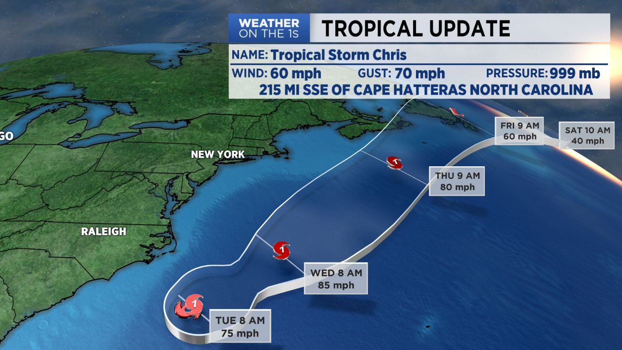
With such beautiful weather it may be hard to believe there’s a strengthening tropical storm about 200 miles offshore.
We’ll keep the sunshine around for one more day as the temperatures begin to heat up. Expect highs in the low 90s Tuesday afternoon and low to mid 90s Wednesday.
Clouds will take up more of the sky Wednesday as a cold front begins to move through the area. Expect the return of scattered showers and storms late Wednesday into Thursday. The good news is Friday and at least the beginning of the upcoming weekend is looking dry and sunny!
TROPICAL STORM CHRIS UPDATE
Tropical Storm Chris continues to meander just to our east. At last check, the center of circulation was about 200 miles south of Cape Hatteras.
Based off the latest data, Chris will become more organized and likely become a category 1 hurricane late tonight or early Tuesday morning.
The good news is Chris will likely not make landfall here in North Carolina or anywhere along the eastern seaboard. High pressure over the northern Mid-Atlantic States and a trough digging into the New England area will steer it back out to sea.
Chris will remain at its current location for another day or so and then begin moving northeast late Tuesday/early Wednesday. Until then, we’ll continue to deal with a HIGH rip current risk along all of North Carolina’s beaches.
Get the latest news, sports and weather delivered straight to your inbox. Click here to sign up for email and text alerts.