


Another hot and humid day forecast for Sunday.
- Highs in the mid 90s Sunday
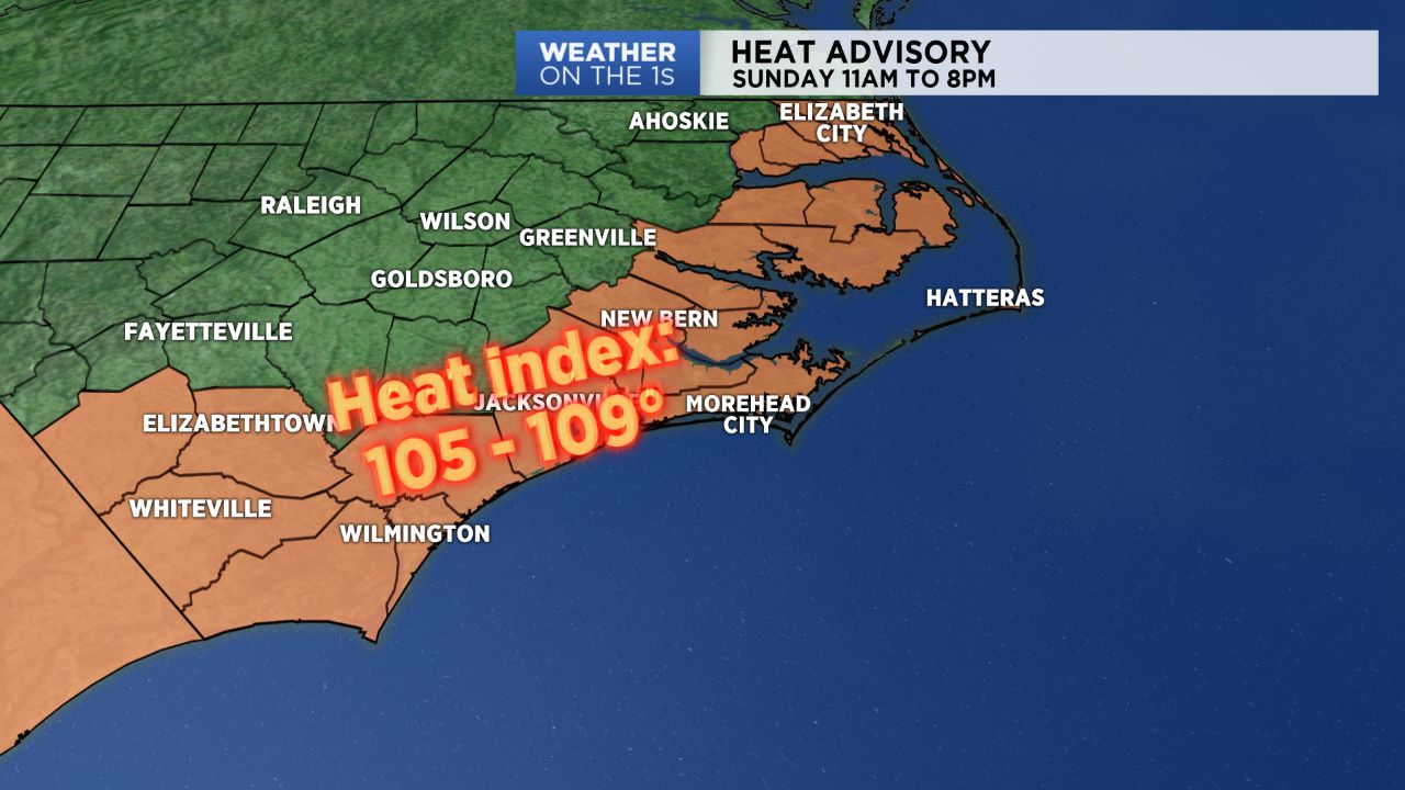
- Heat index values could reach 109 degrees
- Scattered showers for Sunday
Look for highs reaching into the mid 90s inland and near 90 along the immediate coast. Heat Index values could reach 105-109 during the afternoon and evening hours prompting a Heat Advisory for much of eastern North Carolina. We’ll see widely scattered afternoon thunderstorms to cool things down and add to the already oppressive humidity.
A cold front will slowly settle south across the state on Monday and we will see more clouds and a better chance for showers and thunderstorms to cool us down a little.
By Tuesday, with the cold front well south, a more northerly wind flow will be in place allowing for sunny and dry day with seasonable temperatures in the mid to upper 80s.
Get the latest news, sports and weather delivered straight to your inbox. Click here to sign up for email and text alerts.