


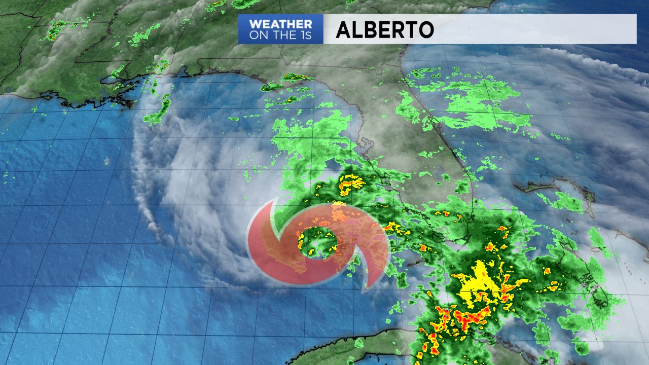
NORTH CAROLINA -- Subtropical Storm Alberto continues moving north across the Gulf of Mexico and is forecast to make landfall Monday afternoon along the central Gulf coast. While the storm's remnants may not track over the Carolinas, abundant tropical moisture from the system will bring heavy rain to North Carolina early next week.
Expect just isolated showers and thunderstorms through Sunday afternoon and evening. Then overnight a shield of rain will overspread the region from south to north and continue all day for Memorial Day.
Everyone will showers and thunderstorms with heavy downpours with the heaviest rain falling across southeastern North Carolina. Recent wet weather combined with the downpours could lead to flash flooding and a Flash Flood Watch has been issued for late Sunday night through Tuesday and may be expended in time and coverage.
Flooding concerns will continue through at least the middle of next week. Lingering tropical moisture over the region will keep scattered showers and storms in the forecast most days next week. It now appears most of North Carolina will see around two to five inches of rain through next week. Locally higher amounts are possible especially in southeastern North Carolina.
Stay tuned to Weather on the 1s on Spectrum News for updates.