


WILMINGTON, N.C. -- In advance of a strong cold front, breezy and warm conditions have prevailed so far this weekend. As the front moves into North Carolina spotty showers will be with us through midday.
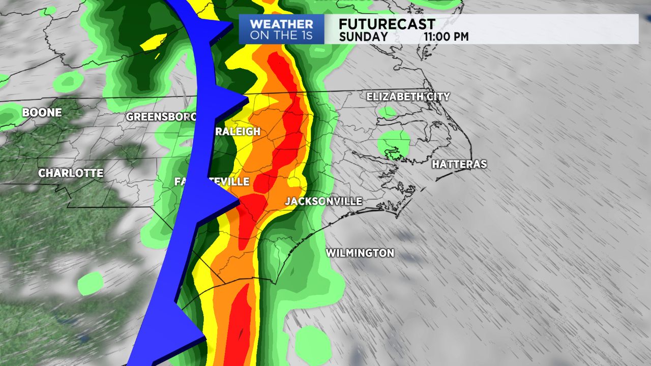
Into the afternoon, showers and scattered thunderstorms will prevail. Into the nighttime hours, a line of strong storms will move into eastern North Carolina with severe weather possible.
Some storms could produce damaging winds and heavy downpours. We could also see hail and isolated tornadoes. The line of storms should push east of the region as we head toward daybreak Monday.
Breezy and cooler conditions are expected for Monday as high pressure builds into the state.
Stay with Spectrum News as we monitor any severe weather threat for our area.