


Snow is spreading across central North Carolina during the day on Wednesday, that precipitation will cross eastern North Carolina Wednesday evening into Wednesday night.
Snow will develop across northeastern North Carolina through the evening near Elizabeth City and the northern Outer Banks.
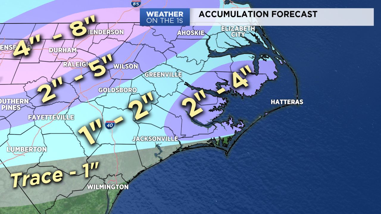
The change to snow will take longer in southeastern North Carolina including locations near Wilmington and Jacksonville.
The snow will not last very long around Wilmington Wednesday night, so little to no accumulation is expected. Jacksonville could see one to three inches.
A band of snow may linger late into the night from Carteret County to the central Outer Banks. That could allow two to four inches of snow to accumulate in those locations through the night.
All of the snow will come to an end well before sunrise Thursday morning as temperatures drop to the 20s.
Even locations that see little to no snow accumulation could see icy spots on roads for the Thursday morning commute.
Track the winter storm across North Carolina with our interactive radar
Stay tuned to Weather on the 1s for weather updates through the day and night.