


Winter is making a comeback across North Carolina this week. Snow will spread across western and central North Carolina from late Tuesday night through Wednesday morning.
Here in eastern North Carolina, the precipitation should start mainly as rain late Wednesday morning before switching to snow in the afternoon.
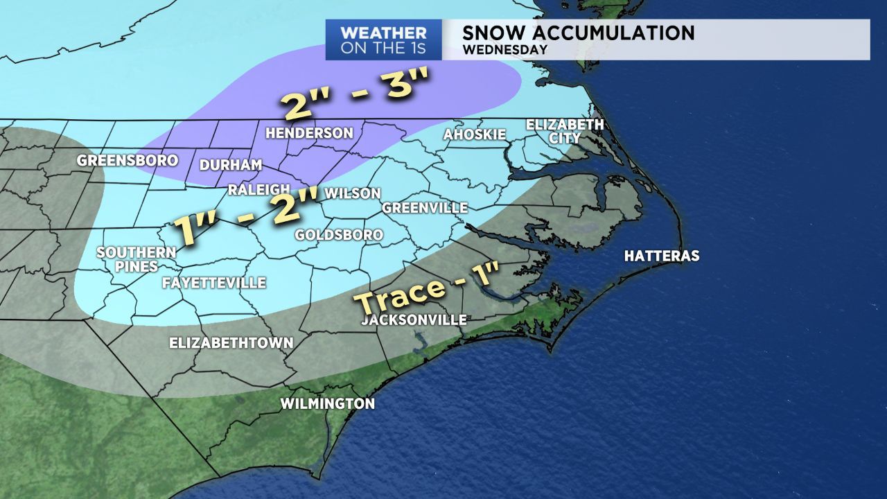
The best chance for accumulating snow in this region will be in northeastern North Carolina where very little rain is expected before the snow begins. One to three inches of snow is possible from near Greenville to the north around Elizabeth City and Ahoskie. A dusting to two inches is possible along the Outer Banks.
South of Greenville and closer to Wilmington and Jacksonville, temperatures will warm into the 40s through midday Wednesday, so there will likely be a longer period of chilly rain showers. The rain should at least briefly switch to snow before ending in the late afternoon and early evening hours.
Very little if any accumulation is expected in Wilmington and along the immediate coast near Morehead City and Beaufort. Locations a little further inland from Whiteville and Elizabethtown to Jacksonville could see anywhere from a light dusting to one inch.
Stay tuned to Weather on the 1s on Spectrum News for updates to the forecast.
Get the latest news, sports and weather delivered straight to your inbox. Click here to sign up for email and text alerts.