


After several days of above average temperatures, it looks like another cool-down is in the forecast, a cold front will sweep across North Carolina through the evening. Behind the front, cooler air will build in for the weekend.
As the front moves through, we'll see the chance for showers and isolated thunderstorms. With the passage of the front, showers will taper off as cooler air builds into the region.
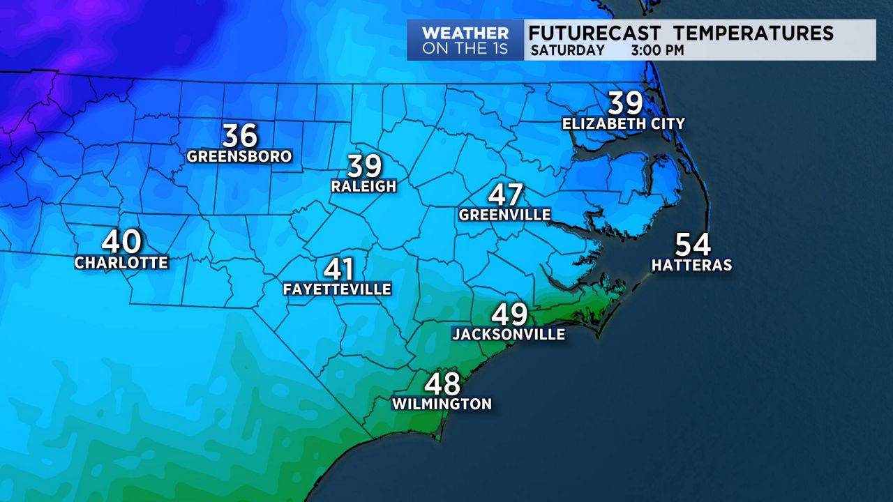
There will be a mix of sun and clouds on Saturday, and as the colder air moves into the state, we may see our afternoon highs early in the day, with temperatures dropping through the afternoon. Even with a full day of sunshine on Sunday, many areas will see daytime highs only in the 30s.
We'll start the new week with lots of sunshine but with cold air in place, temperatures will run below average for much of next week.
Watch Spectrum News for your complete weekend forecast.