


It is about to get colder in North Carolina! A cold front passing through the state Tuesday will bring some of the coldest temperatures and certainly the lowest wind chills that we've seen so far this season.
Before the coldest air arrives, high temperatures Tuesday afternoon will range from the 30s in the mountains to the 60s along the coast. In the Piedmont, look for highs in the upper 40s around Greensboro and the low 50s near Charlotte and Raleigh.
As the cold air moves over the mountains, snow showers are likely Tuesday in western North Carolina. Up to two inches of snow is possible in the highest elevations. The rest of the state will stay dry with partly sunny skies.
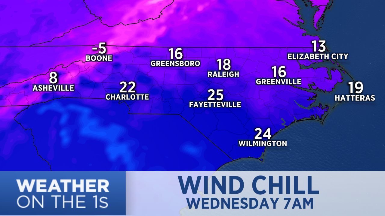
It will be breezy statewide Tuesday afternoon and night as the cold front moves to the east. That will make it feel even colder Tuesday night and Wednesday morning. Low temperatures will range from the teens in the mountains and foothills to the 20s from the Piedmont to the coast.
Wind chills, or feels like temperatures, will drop below 0 in the northern mountains around Boone where a Wind Chilly Advisory has been issued. Western North Carolina residents are warned that frostbite could develop on exposed skin in less than 30 minutes with those low wind chills. Everyone is encouraged to dress in layers and wear a winter hat and gloves.
The Piedmont and central North Carolina will likely wake up Wednesday morning to wind chills in the teens. Southeastern North Carolina including much of the coast will see wind chills in the low to mid 20s.