


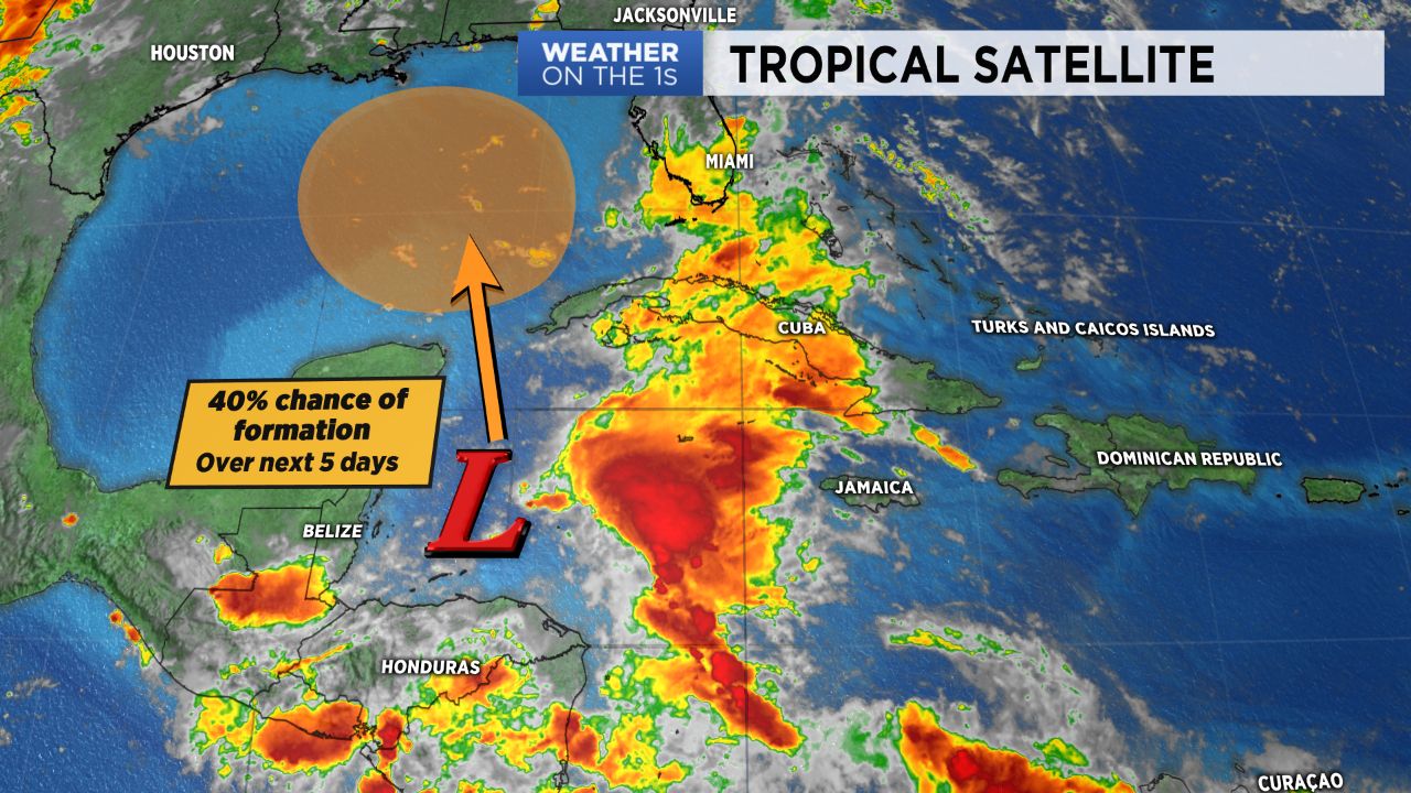
More rounds of scattered showers and storms will continue through mid-week before a developing area of low pressure in the northwestern Caribbean will likely bring heavy rain across the Southeast and into the Carolinas for Memorial Day weekend.
- Heavy rain likely for Memorial Day weekend.
- Cold front pushing through Wednesday will bring more scattered showers.
- Showers also possible Tuesday afternoon.
Expect more of the same today as moist southerly flow continues through the middle of the week. More rounds of showers and storms will be possible this afternoon, especially in the mountains and foothills, where torrential downpours will continue to be the largest threat as localized flash flooding still remains a concern. Highs today will be in the low to mid 80s with dew points in the mid/upper 60s. A cold front pushing in from the north Wednesday will bring additional rounds of scattered showers and thunderstorms before some brief dry-time Thursday.
After a lull in the action Thursday, expect an increasing chance for showers and storms heading into the holiday weekend. A developing area of low pressure in the Caribbean will likely push onto the Gulf Coast sometime Sunday. While it's path still remains uncertain, we can be fairly sure that it will bring wet weather -- and, perhaps, some very heavy rain -- across North Carolina throughout the holiday weekend. Stay tuned! Details will become more certain over the next few days.
Get the latest news, sports and weather delivered straight to your inbox. Click here to sign up for email and text alerts.