


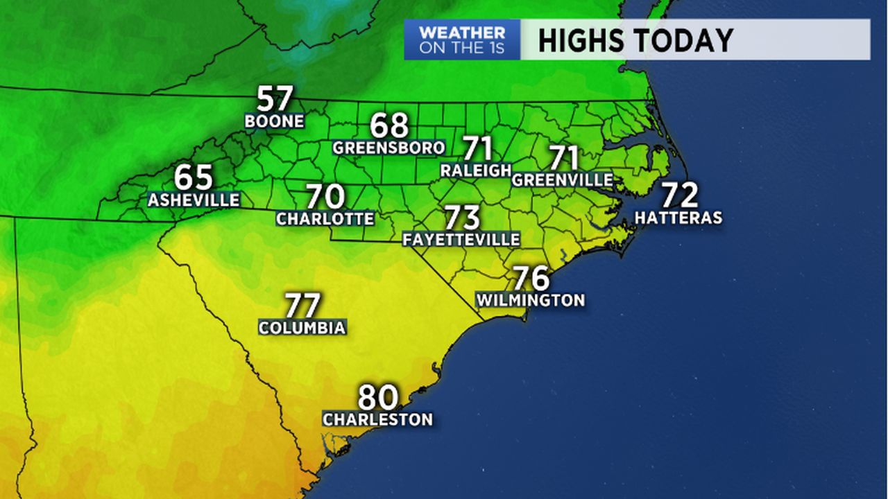
WILMINGTON, N.C. -- Ahhhhhhh. After weeks on end of very warm and extremely humid weather, culminating with the passing of Tropical Storm Michael, we have finally have some cooler, drier air settling into the Carolinas. In fact, high temperatures today will likely wind up just a touch below the mid-October averages for many in the region.
- A few showers can't be ruled out around the northern Outer Banks
- Most of us will have a sunny Saturday sky with highs in the 70s
- Look for more clouds for Sunday with highs comparable to today
A few showers can't be ruled out around the northern Outer Banks, but most of us will have a sunny Saturday sky with highs in the 70s.
Look for more clouds for Sunday with highs comparable to today.
A cold front will slowly approach and move through the region early next work week. Our best shower chances with that front will likely occur Tuesday and Wednesday.
Following that front, a fresh push of cooler and drier air will take over for Thursday and Friday.
Get the latest news, sports and weather delivered straight to your inbox. Click here to sign up for email and text alerts.