


After ripping through the panhandle of Florida and working through Georgia Wednesday and Wednesday evening, Michael is headed Carolina way.
We'll see periods of heavy rain and gusty winds starting around the morning commute Thursday. I expect to be under Michael's thumb through mid-evening in Charlotte. Areas east of Charlotte could continue with storm impacts through late Thursday night.
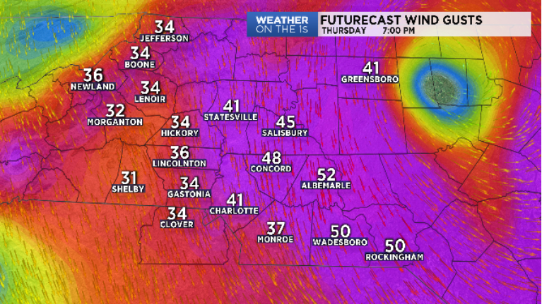
Winds gust to 40 or 50 mph appear possible east of the I-77 zone. Anson, Richmond, Stanly and Union Counties remain under a "Tropical Storm WARNING" through late Thursday. It is in these areas some of the wind gusts could do some damage.
Rain totals of 3" to 4" plus are possible. Locally heavier amounts may develop. Flooding and flash flooding will be a concern through the day. Mountain counties have already had some flooding just from showers Wednesday. Small creeks, streams and rivers will all need to be monitored for flooding. Please stay WEATHER AWARE through the day.
A small risk for a brief, weak, tornado or two may be possible in the very early hours of Thursday. As of this post, the better zone appears to be south down SC way. By mid-morning, that limited threat should shift into eastern NC.
A clearing sky is expected very early Friday. Cool fall temperatures will settle across the area for the weekend. Sunshine and dry will rule the roost.