


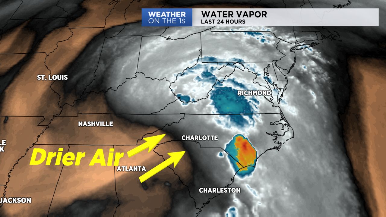
CHARLOTTE -- After a day of record rainfall for many Sunday, including Charlotte, drier air will begin moving in across the Piedmont as the remnants of Florence lift farther to the north. River levels will remain at or above flood stage for some areas, so potential flooding remains a concern.
What's left of Florence continues to (finally!) lift to the north. Though some leftover instability may lead to some scattered showers and storms today, they should be much shorter lived than the rain we experienced all weekend long and, therefore, likely leading to smaller amounts. Expect additional rain totals between a tenth to a quarter of an inch, with heavier amounts expected locally. While additional rainfall certainly won't help the flooding situation, river levels should overall begin improving today, with most across the Piedmont dropping to below flood stage by Tuesday.
Further drying will occur Tuesday and especially Wednesday as high pressure builds in from the west. Expect plenty of sunshine to resume across the region starting Wednesday and continuing through the work week. Additional rounds of showers and storms may be possible over the upcoming weekend.
Stay up to date on the clean-up and aftermath of Florence:
- Florence resources and helpful links
- How to begin the steps to recovery
- Residents return after Florence
- Like us on Facebook
- Watch Live
- Closings and delays
- Download the App