


It's been an interesting 24 hours with modeling and the forecast track for Hurricane Florence. Tuesday afternoon, thus far, reliable Euro suggested that maybe Florence doesn't move inland around Wilmington after all. Rather, it's suggesting the core of Florence meanders just off the coast for Friday and most of Saturday, before (are you ready for this?), heading SW to Charleston, SC in a weakened form. Jaw drop I know.
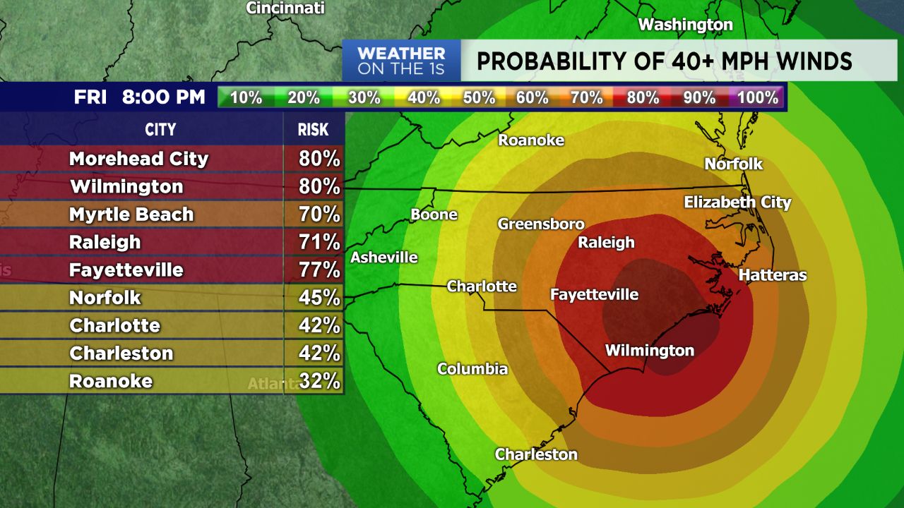
NHC has broadened the "Cone of uncertainty" for Florence beyond day 3. As of this late Tuesday post, we still expect heavy rain and some gusty winds across the Charlotte region Friday into Saturday. The biggest punch appears, for now, to be late Friday night into early Saturday morning.
I can't stress enough the need to continue preparing for this storm. If for some reason we luck out, and Florence does head SW, then so be it. But for now, we have to act on the information we have at hand; prepare.
NC mountain folks, flooding and flash flooding continue to be a real concern. Current data suggest 5-8" of rain could be possible. If those numbers verify, then we have a problem for the High Country.
We have the luxury of a few more days to work our storm prep plans. Hopefully by Wednesday night, we have more consistent modeling in terms of the track. Tropical systems are enough to drive a meteorologist nuts.