


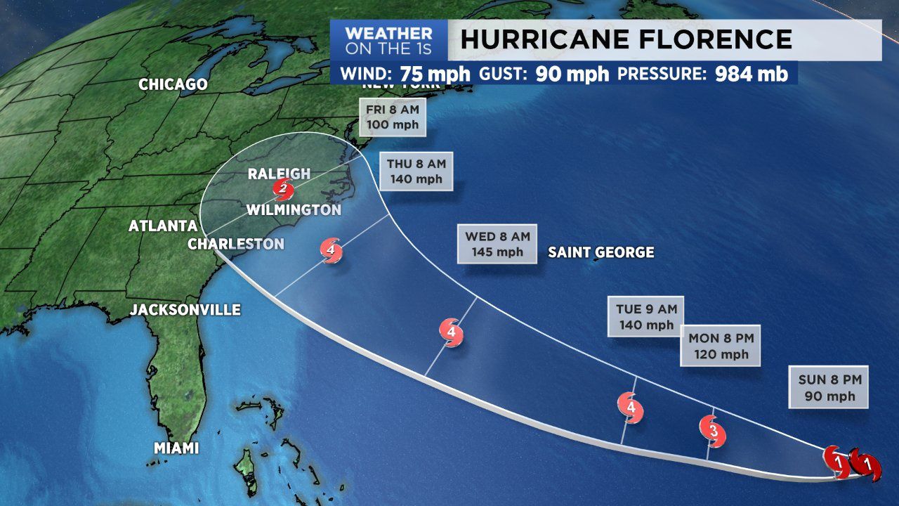
As expected, Tropical Storm Florence was upgraded to a Category 1 hurricane Sunday morning by the National Hurricane Center. The storm now has maximum sustained winds of 75 mph and gusts as high as 90 mph. Hurricane Florence is 750 miles southeast of Bermuda and is tracking west at 6 mph. Over the next 24 to 48 hours, wind shear around Florence will continue to decrease allowing the storm to rapidly intensify. It will likely become a major hurricane as early as Monday, reaching Category 3 criteria. It will continue to strengthen and likely upgrade to a Category 4 by Tuesday.
Based off the latest forecast track from the NHC, Florence will approach the southeast U.S. coast by Thursday. The confidence in a North Carolina landfall Thursday night is growing, but there's still room for improvement regarding model disagreement. But going off the NHC forecast, Florence looks to come well inland to central North Carolina late Thursday and through the day Friday. This means much of the state may deal with flooding, wind damage resulting in downed trees and powerlines. Power outages due to high winds and damage may last to days to a week for some areas.
Now of course all of this is dependent on the track of Florence. If it trends more east then our possible impacts will decrease. If it comes well inland then a vast majority of the state will be impacted. So between now and Thursday, remain informed as we continue to provide updates. The forecast is constantly changing with each new model run so don't assume what you read today will hold true Tuesday or Wednesday. Also take this time to prepare, have a hurricane preparedness kit and have a plan in place with your family in case the worst arrives with Hurricane Florence.