


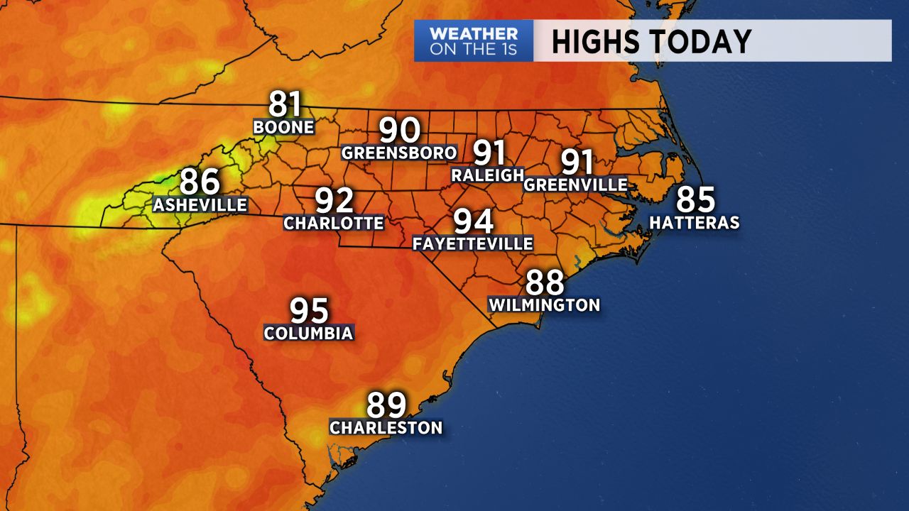
Coming off of the 11th day in a row of 90-degree temperatures here in Charlotte... and today will made a 12th! Changes arrive for the weekend as a cold front drops in from the north. In the meantime, we continue to keep a close eye on Hurricane Florence.
With a ridge of high pressure still over the mid-Atlantic today, we're heading into essentially the same weather as we've seen since last week: hot with minimal chances for showers. Highs will yet again soar into the 90s for many across the Piedmont. Friday may feature a slightly better chance for afternoon showers and storms, though they will still remain widely scattered across the region.
A cold front will begin moving southward over the weekend, bringing an increasing chance for showers and storms each day. With the front is set to be just to the south of us Sunday, expect a bit of a cool down (finally!). Highs will drop from the low 90s into the low/mid 80s Sunday into next week.
While the track for Florence still remains very uncertain, there is potential for an East Coast landfall sometime during the middle of next week. We'll continue to narrow down the details of Florence and its track as we head into the coming days. Stay tuned!
Get the latest news, sports and weather delivered straight to your inbox. Click here to sign up for email and text alerts.