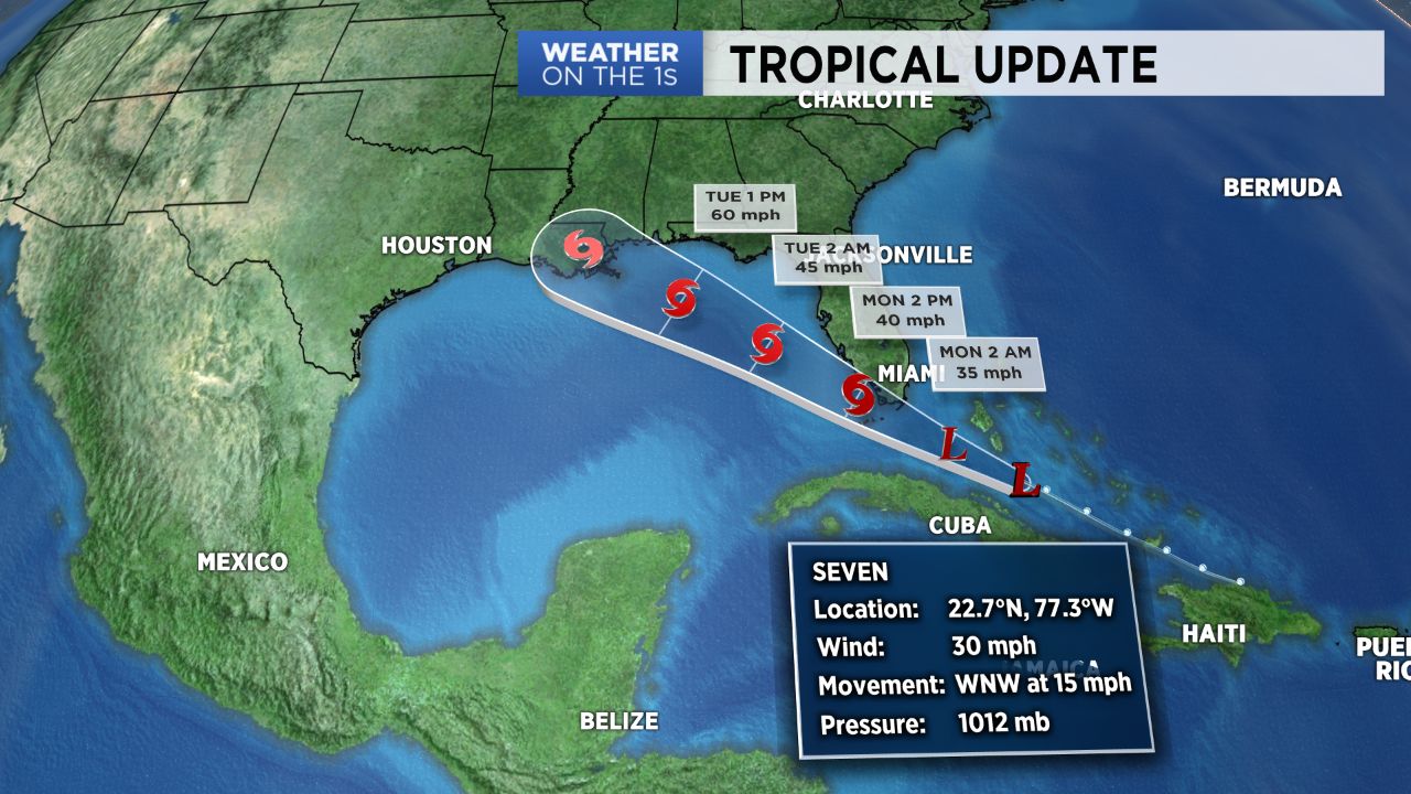
A tropical wave is headed for the Gulf of Mexico and it will likely develop. The Hurricane Center has classified it as "Potential Tropical Cyclone #7" but it will likely be named "Gordon" within the next 24 hours or so. It's forecast to be a fairly strong tropical storm by the time it makes landfall later Tuesday somewhere near New Orleans. There will be little to no impact here. Our Labor day will feature more heat and humidity with a few afternoon and evening storms. Stay safe out there!
Tropical Trouble in the Gulf
PUBLISHED September 2, 2018 @7:12 PM


