


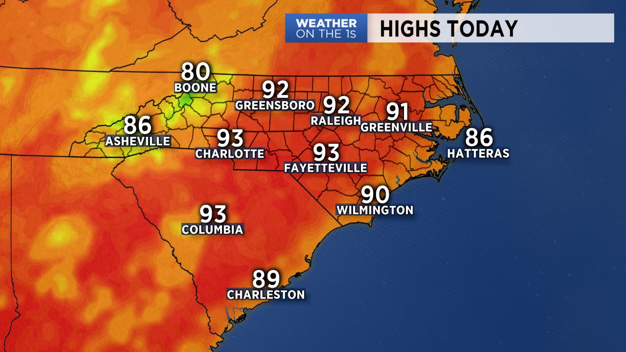
CHARLOTTE, N.C. -- After a week of wet and cooler conditions last week, this week will feature the return to a very typical summertime weather pattern. Expect hot, humid days ahead with daily chances for scattered thunderstorm activity coupled with plenty of dry time.
- Hot and humid days in store for the week.
- Scattered thunderstorm activity is possible daily.
- Heat index values may reach near 100 degrees.
High pressure building across the Southeast will yield another day in the 90s for many Monday. Dewpoints will be in the upper 60s to low 70s, so heat index values will likely reach near 100 degrees for some areas across the Piedmont. As we typically see this time of year, we'll watch for some weak, scattered thunderstorm activity to develop late in the afternoon with better chances confined to the mountains. The majority of locations should remain storm-free under partly cloudy skies.
The same weather will persist into Thursday before storm chances see a slight uptick by the end of the week and, consequently, daytime highs cool down a tad. Overall, not much of a difference will be noticed, so its time we settle in to this very August-like pattern!
Get the latest news, sports and weather delivered straight to your inbox. Click here to sign up for email and text alerts.