


A strong system to our west will push southeastward today and into North Carolina, bringing us strong to possibly severe storms ahead of it Saturday afternoon into Saturday evening. This will kick off a wetter, unsettled, and cooler weather pattern that will last well into next week.
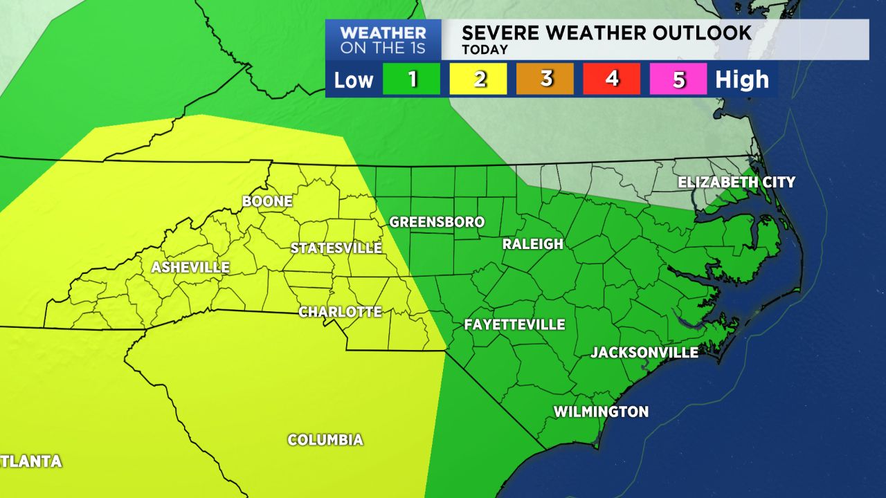
A strong area of low pressure circulating across the southern Great Lakes region will meander into the Ohio Valley today, bringing its cold front across the spine of the Appalachians. As this system approaches, a few showers and embedded storms will be possible by late morning into early this afternoon with a chance for scattered severe storms by late Saturday. While today won't be a washout, any storms that do happen to develop could be capable of producing damaging winds and large hail. Highs today will be near average, topping off in the mid to upper 80s.
Sunday will feature additional scattered showers and storms but the severe potential is thankfully low. Most storms should just be weak and occur in the afternoon.
By Monday, this system will shift to parts of the Deep South and continue to circulate there for the next few days after that, pumping plenty of moisture into the Carolinas. We'll look for daily chances for showers and storms, which could produce 2 to 4 inches of needed rain by about mid-week across the Piedmont and Triad. With the additional cloud cover, temperatures will also be slightly cooler, with highs remaining in the low to mid/upper 80s.