


NORTH CAROLINA -- Sunday will bring another typical July day across both the Piedmont and Triad, with near average warmth and isolated to scattered chances for showers and storms.
- The chance for rain and storms will ramp up for the start of the work week
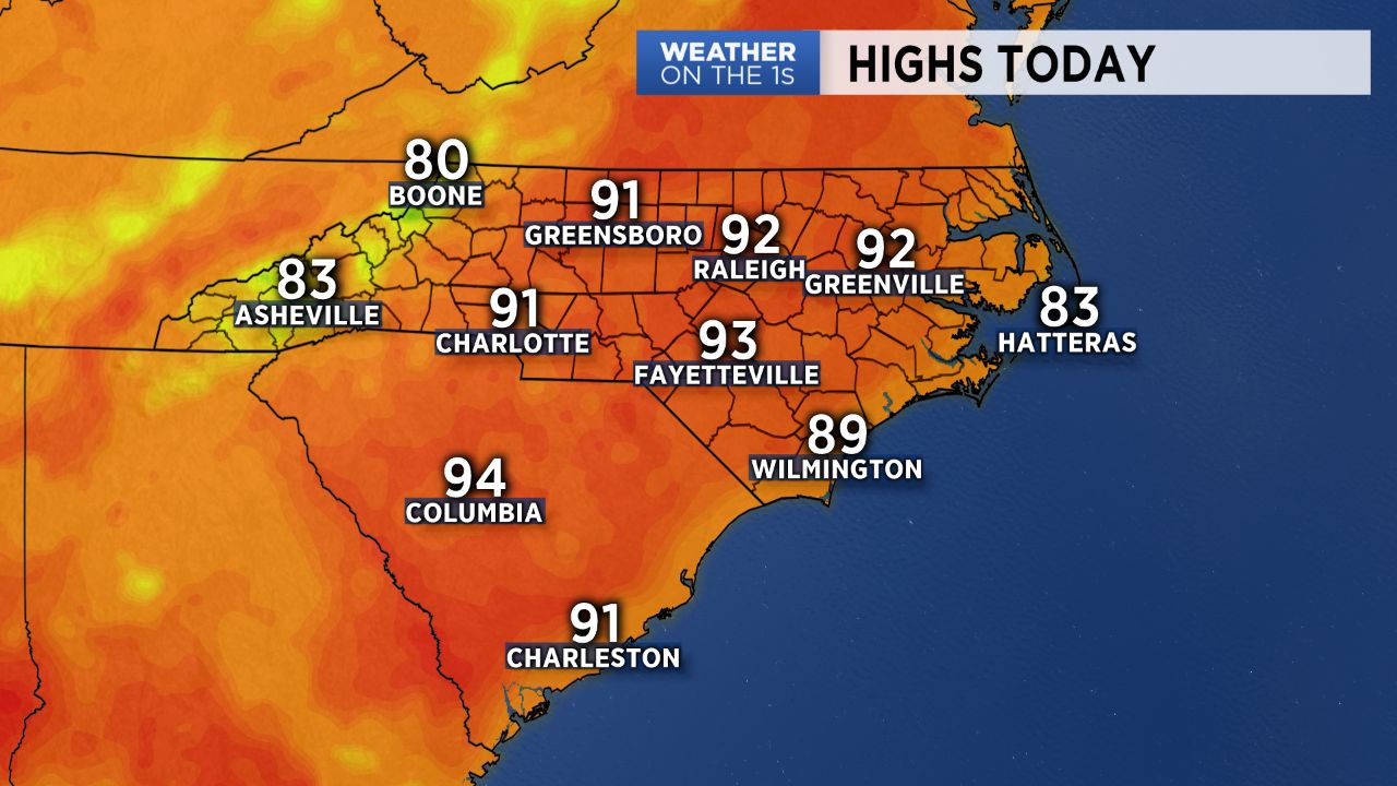
- Expect another relatively quiet day Sunday across the lower elevations with highs warming back into the upper 80s and low 90s
- Clouds will build in for Monday ahead of a wave of energy that will produce storms across the region late Monday afternoon into Monday evening
The chance for rain and storms will ramp up for the start of the work week ahead of an approaching cold front.
Expect another relatively quiet day Sunday across the lower elevations with highs warming back into the upper 80s and low 90s as they did Saturday.
Chances for showers and a few weak storms will be best in the mountains, with that chance decreasing the farther east you work. Most across the Piedmont will enjoy a dry Sunday under partly cloudy skies.
Clouds will build in for Monday ahead of a wave of energy that will produce storms across the region late Monday afternoon into Monday evening, with much better coverage expected than what we've seen over the weekend.
A cold front moving through Tuesday will bring another round of showers and storms to the region before high pressure builds in briefly for late Wednesday into Thursday, leading to a mostly dry middle of the week.
Temperatures will be near average for the next several days with highs in the mid/upper 80s to low 90s.
Get the latest news, sports and weather delivered straight to your inbox. Click here to sign up for email and text alerts.