


A cold front that passed through North Carolina Monday afternoon will bring a decent cool down for Tuesday, but will be briefly lived. Soak in the cooler conditions while we have them! The heat and humidity make a quick comeback Wednesday through the remainder of the week.
- Cool down comes in for Tuesday, but won't stay for long.
- Most areas should remain dry.
- Summer-like conditions return Wednesday.
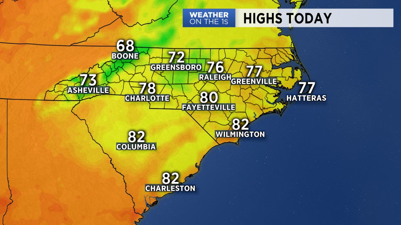
Behind yesterday's cold front, temperatures are a bit cooler to kick off Tuesday morning with winds back out of the north and east. High pressure scooting off the New England coast will set us up to see a brief cold-air damming scenario Tuesday, bringing us a day of mostly cloudy skies and below average temperatures. Highs will likely only make it into the 70s for the majority of the Piedmont with 60s in the mountains. A few sprinkles will be possible through the day, but most areas should remain dry.
Summer-like conditions make a quick comeback Wednesday. Highs will soar back into the mid 80s to low 90s and be coupled with higher humidity. As we typically see during the summer, scattered showers and storms will also make a return to the forecast for the rest of the work week and continue into Father's Day weekend.
Get the latest news, sports and weather delivered straight to your inbox. Click here to sign up for email and text alerts.