


Wednesday brought another day of showers and storms across the region, where some parts of the High Country picked up over an inch within 24 hours. Each day, Thursday into the weekend and even next work week will bring additional rounds of showers and storms across the region.
- Rounds of showers and storms will continue to move in.
- Flash Flood Watches issued for mountain counties.
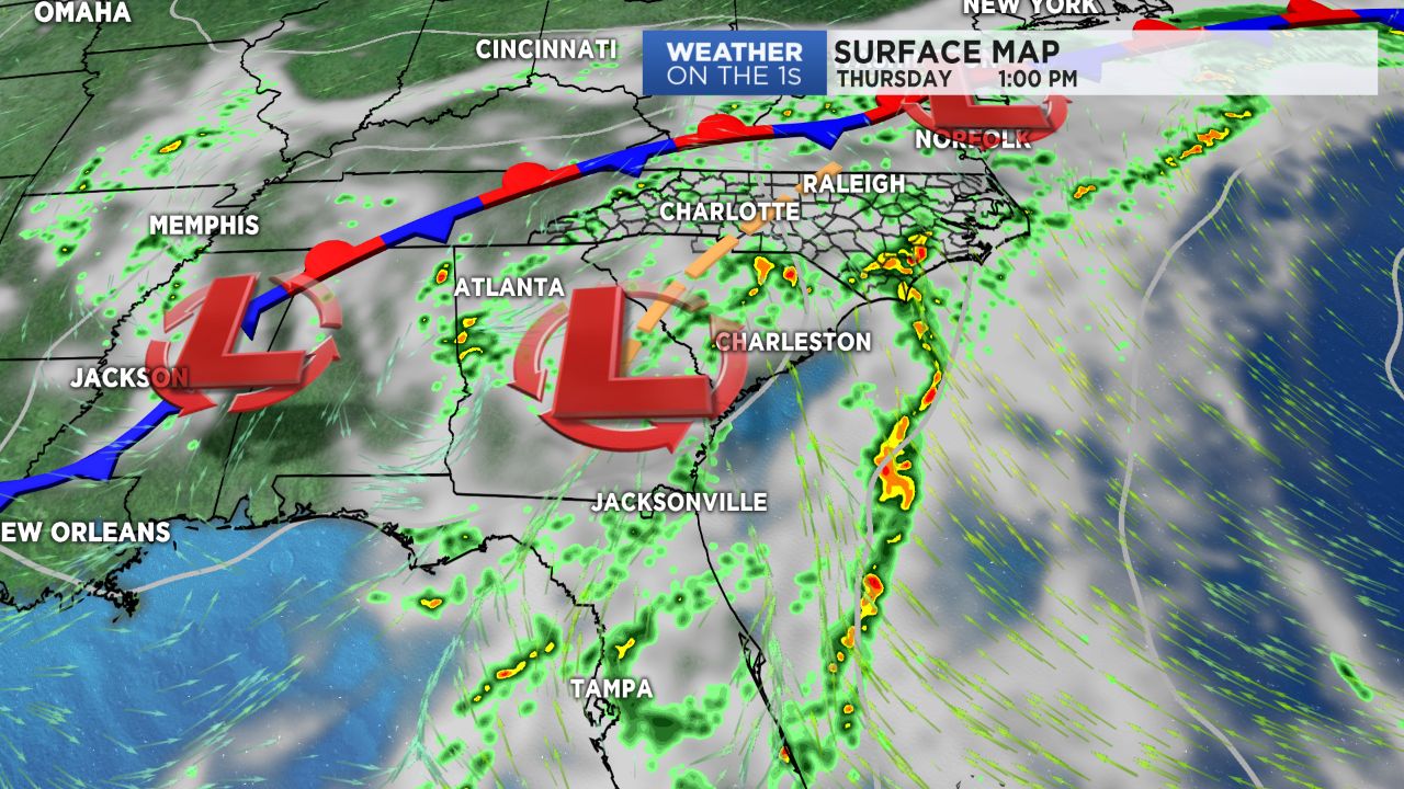
- Low pressure will work its way in over the next 48 hours.
A slow moving area of low pressure continues to work its way along the Florida Panhandle today and will slowly meander its way northward over the next 48 hours. This will lead to an increased chance for showers and storms both Thursday and Friday. The mountains have already picked up over an inch of rain in some areas, allowing soils to become quite saturated. With more rounds of wet weather on the way for the next couple of days, Flash Flood Watches have been issued for Ashe, Watauga, Avery, Burke, and Caldwell counties where small streams and creeks may experience some flooding. Torrential downpours will likely be an issue with any thunderstorms that may develop by both Thursday and Friday afternoon.
Things will remain rather persistent in both the temperature and rain/storm department through the weekend. Expect highs to remain in the upper 70s to low/mid 80s each day with nights in the mid and upper 60s. While storm chances should be slightly smaller over the weekend, we will still likely be looking at scattered afternoon storms for both Saturday and Sunday with additional rain chances on the way for next week.
Get the latest news, sports and weather delivered straight to your inbox. Click here to sign up for email and text alerts.