


A soupy tropical airmass is in place around the entire region, and in this type of airmass, it is very easy for showers and storms to develop.
Our Wednesday will feature numerous showers and storms with local highs in the upper 70s. If you are heading over to the Triangle region for the teacher rally, it's the same basic idea.... warm and humid with showers and storms scattered around the region.
An area of low pressure has pulled in deep tropical moisture with origins in the Caribbean Sea.
This airmass will remain in place for the next few days. With that being the case, at any point in time, day or night, we will have the chance of some showers and storms.
However, the greatest coverage of showers and storms will likely be from mid afternoon through the evening hours.
Over the weekend, while we will still have the chance of some showers and storms, the amount of shower/ storm activity will likely decrease.
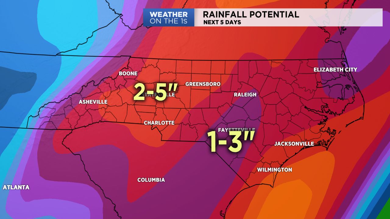
Rainfall amounts today through the weekend will likely be in the 2-5" for many in the area.
Get the latest news, sports and weather delivered straight to your inbox. Click here to sign up for email and text alerts.