


After yet another day in the 90s Monday, the weather pattern will make a shift to cooler and unsettled conditions Tuesday -- a pattern that will stick with us at least the next week.
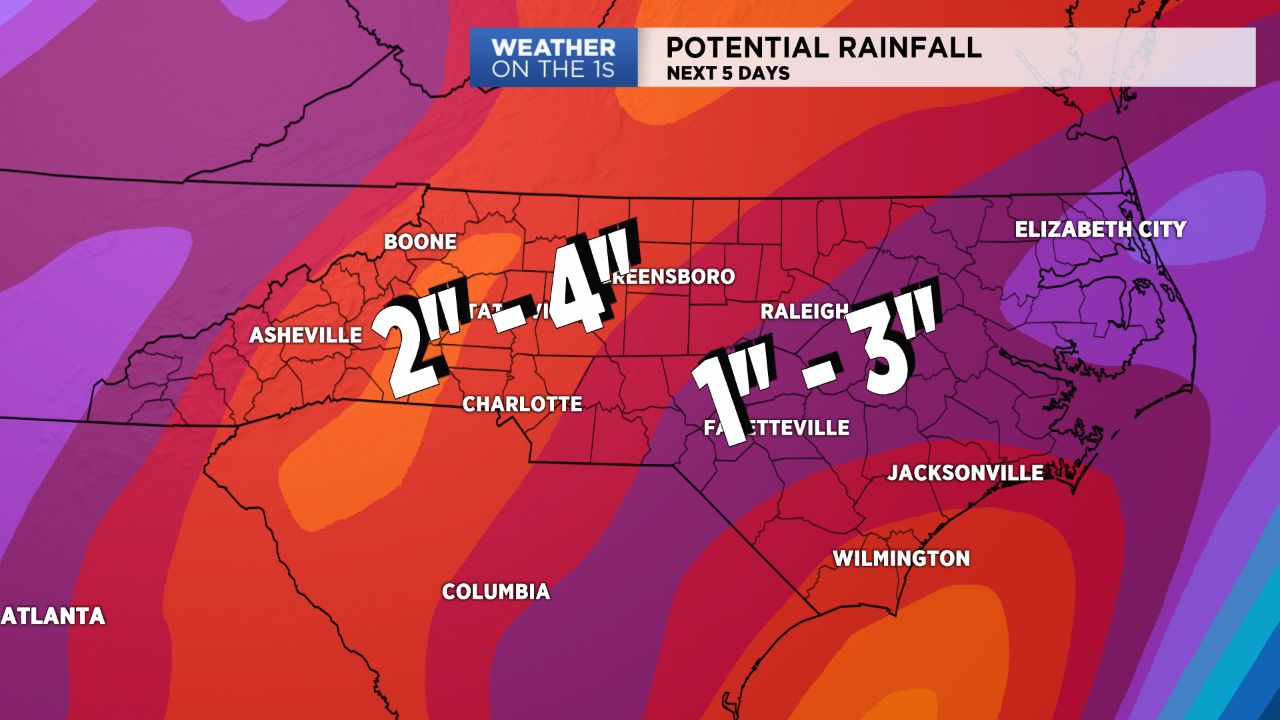
- Low pressure will slowly bring a trail of moisture.
- Temperatures may be cooler due to cloud cover.
- 5-day potential rainfall totals will likely be 2-4 inches.
A slow moving area of low pressure over the northern Gulf of Mexico will slowly meander its way northward over the next few days, allowing for a trail of moisture to infiltrate the Carolinas. This will translate to abundant cloud cover and daily chances for scattered showers and storms. Due to the cloud cover, temperatures will also be cooler than the past few days. Expect highs to remain in the upper 70s and low 80s for the rest of this work week and into the weekend with 60s to low 70s in the mountains. Lows will be kept mild overnight, with nightly temperatures only cooling into the mid and upper 60s.
Though we will likely see scattered storms each and every afternoon straight into the upcoming weekend, the severe threat, for now, looks low over the next three days. Most storms should just be of the garden-variety type. We should, however, pick up a good amount of rainfall over the course of this work week, with 5-day potential rainfall totals ranging from 2 to 4 inches across the area (highest amounts will likely be in the mountains and foothills).