


After a morning of record tying cold Tuesday in Charlotte, the "weather rollercoaster" continues Wednesday as temperatures soar to unseasonably warm levels. Dry and breezy conditions in place will also lead to heightened fire danger across the region.
With a strong southwesterly flow ushering in warm air Wednesday, temperatures will warm quickly into the 70s and low 80s by the afternoon under mostly sunny skies. With a system approaching from the west, winds will pick up throughout the day, with gusts near 25 to 30 mph possible by late this afternoon into this evening.
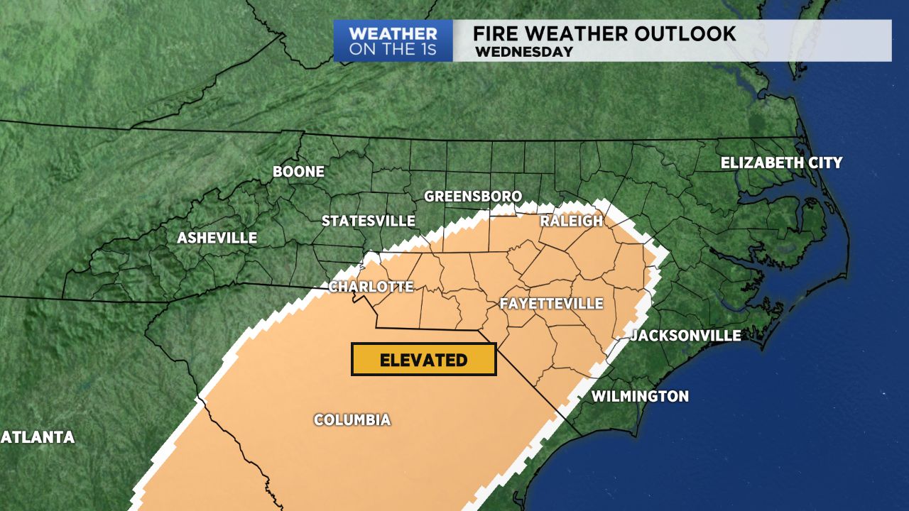
Unfortunately, with the atmosphere as dry as it is, this will lead to an increased fire danger across the area, with the Storm Prediction Center putting a chunk of the Piedmont under an "Elevated" risk. Hence, outdoor burning is not recommended this afternoon.
A fast moving cold front will push through tonight, bringing just a quick shot of light rain to the mountains before fizzling out as it works its way to the southeast. While lower elevations shouldn't see anything in terms of moisture out of this system, we will feel the cool down.
Daytime highs will cool back into the 60s for the end of the week, but sunshine and dry conditions will prevail into at least the first half of the weekend!
Get the latest news, sports and weather delivered straight to your inbox. Click here to sign up for email and text alerts.