


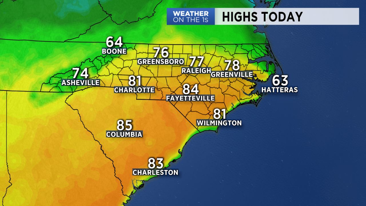
After a day in the low to upper 70s across the Piedmont and Triad Sunday, the weather through Tuesday will remain similarly as warm before our next cold front brings a cool down for late in the work week.
A weak, nearly stationary front will drop southward across central North Carolina Monday afternoon, bringing a small chance for light spot showers across the northern mountains and foothills. However, despite the southward progression of this front, temperatures will still have no problem warming right back into the mid 70s across the Triad to low 80s for parts of the southern Piedmont. Other than some passing high level to mid-level clouds, the weather should remain fairly quiet into Monday evening.
Tuesday will bring yet another day of warm temperatures as the previously mentioned front lifts to the north as a warm front. Highs will warm back into the 70s to low 80s by Tuesday afternoon ahead of an approaching cold front set to pass through early Wednesday morning.
Rain will spread from west to east ahead of the front through Wednesday, with a few thunderstorms possible along the front early Wednesday. With drier air moving in behind it, expect sunshine to return Thursday along with some cooler air. Highs will be back to below-average levels, with temperatures only expected to top off in the 50s to low/mid 60s Thursday afternoon.