


After an evening of active weather Tuesday, the same system that brought us the heavy rain and thunderstorms will continue to impact the region Wednesday --- only this time in a more "wintry" way.
With an area of low pressure now off towards parts of West Virginia, western North Carolina will feel the cooler air wrapping around the backside of it Wednesday, allowing for ongoing accumulating snow in the mountains and the potential to even see a few snow showers east of the mountains.
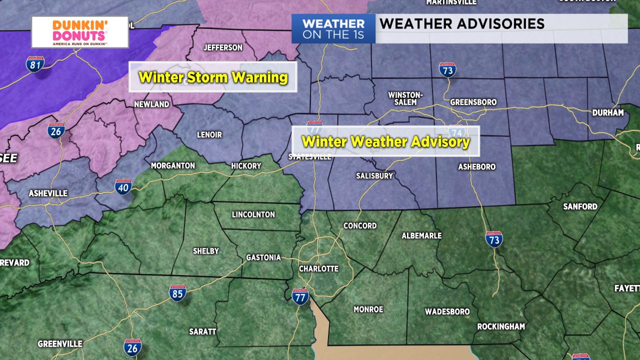
Areas along and to the north of the I-40 corridor will be the best contenders to see a rain/snow mix or some bursts of all snow early Wednesday, where they could accumulate up to a "slushy" inch of snow.
Travel impacts should keep to a minimum in these areas, with accumulations expected to be confined mainly to grassy and elevated surfaces. Nevertheless, Winter Weather Advisories have been issued for Iredell, Rowan, Alexander, and Caldwell counties that will continue into noon today.
The heaviest of the snow will fall in the mountains, where 3"- 5" and local amounts near 8" will be possible. This will be coupled with gusty, northwesterly winds through Thursday. Hence, Winter Storm Warnings remain in effect for Ashe, Watauga, and Avery counties until Thursday morning.
After about 10 a.m. Wednesday, with the exception of the High Country, things will become relatively quiet and chilly. Temperatures will only warm into the 40s for many under mostly cloudy skies.
High pressure building in for Thursday and Friday will lead to a period of sunshine to end out the work week before our next system arrives over the weekend.