


Rain is likely through the overnight hours. Some storms will be possible, but, as of this post, the better dynamics for any severe storms should stay well to our South and Southwest.
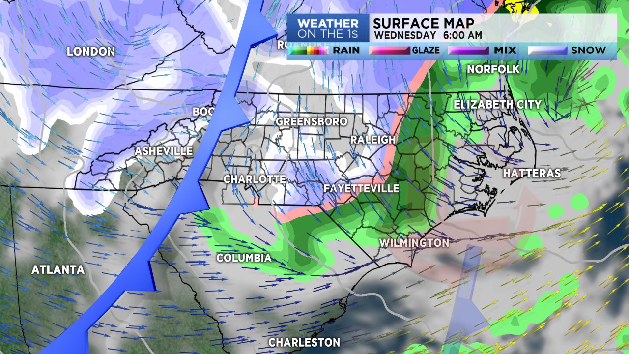
It's a complex set up. Just note, that after the rain, cold air will be sweeping South and we'll feel it Wednesday. There is a chance, early Wednesday morning, we may see one last gasp of snow for what will be the departed Winter season. A few wet flakes, could fall with a cold rain for the Charlotte zone, while some minor accumulations of snow, mainly grassy surfaces, could be seen along the I-40 area.
Our mountain counties could see 2 to 4 inches of snow Tuesday night through early Thursday morning. So, good folks of the High Country, heads up!
We'll see a dryer pattern Thursday afternoon through early Saturday. Rain chances will return Saturday night and stay "possible" through late Monday of next week.
Get the latest news, sports and weather delivered straight to your inbox. Click here to sign up for email and text alerts.