


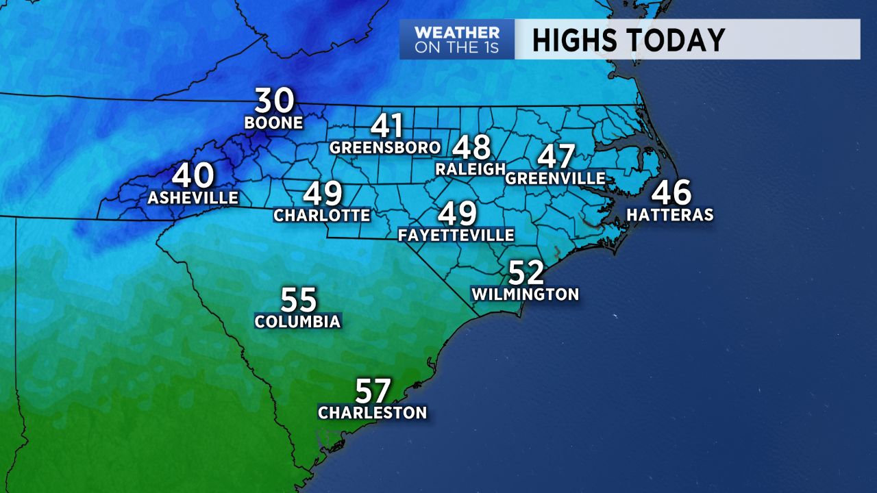
Wednesday will bring another day of well below average temperatures before things begin to warm up quickly through the end of the work week.
An upper level disturbance continues to bring snow showers to the mountains Wednesday morning where Winter Weather Advisories persist for Avery, Ashe, and Watauga counties into the afternoon for additional snow accumulations of a half to an inch of snow.
Snow should continue to taper off into the afternoon, with some sunshine likely by this late in the day.
The Piedmont will enjoy a full day of sunshine but chilly conditions, with highs likely only managing to reach into the 40s for most. This will be coupled with breezy and, at times, gusty winds out of the northwest.
A cold night Wednesday will lead into a warmer day Thursday. High pressure building in across the Gulf Coast states will wrap winds back around to the southwest, allowing for many to reach into the 60s by Thursday afternoon under more sunshine.
By Friday, temperatures should be near 5 degrees above average, with mid 60s to upper 60s on tap for the lower elevations and upper 40s to low 50s slated for the High Country.
A cold front pushing southward through the region will bring spotty showers back across the area late Friday into the weekend, with better chances confined to the mountains.