


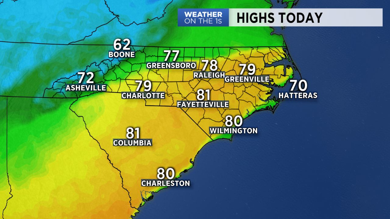
After a unseasonably warm day in the mid and upper 70s Thursday, temperatures will be similarly as warm Friday, likely resulting in a day of record breaking highs for some. This will all come ahead of a strong cold front that will bring a major cool down and the return of wet weather to start the weekend.
High pressure migrating into the southern Atlantic Friday will continue to pump very warm air into the Carolinas. Winds will remain strong, even gusty at times, out of the southwest, allowing for temperatures to soar back into the mid and upper 70s. Some areas could even reach the 80-degree mark! Charlotte's current record for the daytime high on Friday holds at 76 degrees (a record that was set back in 1976). Friday's temperatures will likley break that record.
A cold front moving through Friday afternoon will bring a brief, thin band of showers through the Piedmont late in the day before high pressure builds in behind it and winds shift back to the northeast. Thus, a "wedge" pattern will set up for Saturday, leading into a wet and much cooler day. Highs will likely only manage to reach into the upper 40s region wide under abundant cloud cover with rain moving in by Saturday afternoon into Saturday night. Brief periods of freezing rain will be possible for the northern North Carolina mountains where temperatures are only expected to warm into the upper 30s.
The second half of the weekend looks rather pleasant. With this system moving out by early Sunday morning and the surface wedge eroding, expect a day in the low 60s Sunday with mostly sunny skies.