


Charlotte hit a high of 70 degrees Monday afternoon. With high pressure building across the Northeast, Tuesday will feature a much cooler day across the Piedmont as cold-air damming sets up.
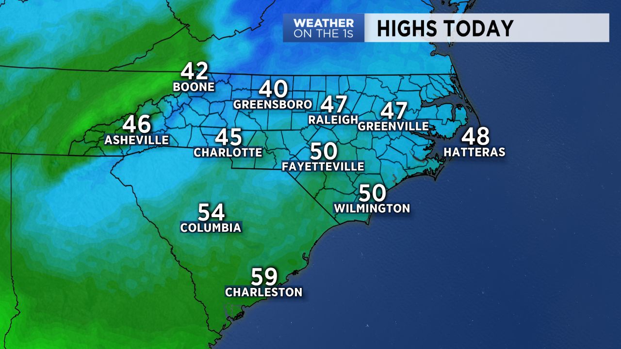
Surface high pressure moving eastward over parts of Pennsylvania and New York Tuesday will allow for winds to shift back out of the north and east, translating to a cool and cloudy day with patchy drizzle possible across the region. Temperatures will likely be about 20 to 25 degrees cooler than Monday, with daytime highs topping off in the mid 40s. Abundant cloud cover will remain in place through this evening with some peaks of sunshine possible in the High Country by late this afternoon.
Wednesday will bring a quick turn around in temperatures. As high pressure to the north breaks down, another area of warm high pressure will begin building in from the south, turning winds back to the southwest and pumping in much warmer air. Highs will be back in the upper 50s to low 60s for Valentine's Day, however, the cloud cover will persist. Rain chances will ramp up slightly Wednesday night into early Thursday, but most precipitation should hold off until the evening hours --- good news for those partaking in the holiday!
Unsettled and warm weather will take us through the end of the work week, with better chances for rain come late Friday as a cold front begins pushing in from the northwest.
Get the latest news, sports and weather delivered straight to your inbox. Click here to sign up for email and text alerts.