


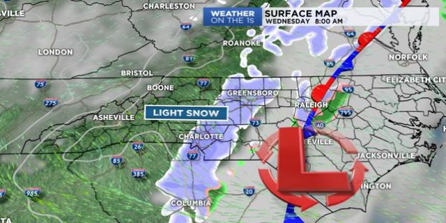
After a chilly weekend across western North Carolina, cold air will stick around through the middle of the week as a cold front pushes through, allowing for the potential of a light, accumulating snow event across the Piedmont.
Monday will remain dry under plenty of sunshine, but despite the sun, temperatures will only warm into the 30s and low 40s. A system pressing westward will prompt increasing cloud cover by Tuesday afternoon as it begins its march through the Tennessee Valley. Snow showers will be possible in the mountains as early as late Tuesday afternoon before spreading east into the Piedmont by early Wednesday morning.
Amount-wise, mountains can expect 1-2 inches. The Piedmont will be in the trace to an inch range, with the largest accumulations expected for areas to the north and east of I-85. With plenty of cold air at the surface, snow will stick to the ground, creating for potentially slippery conditions across roadways Wednesday morning. Stay tuned!
Get the latest news, sports and weather delivered straight to your inbox. Click here to sign up for email and text alerts.