


The mountains woke up to dangerously cold wind chills Wednesday morning with wind gusts near 60 mph for locations like Boone. After a cold start to the morning, both the Piedmont and the mountains will enjoy lots of sunshine Wednesday but will remain well below average as far as temperatures go.
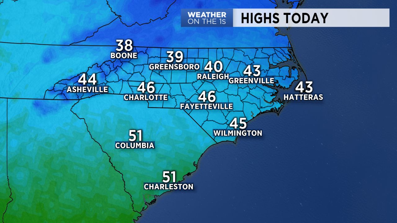
High pressure building into the south of the area will keep conditions dry through Wednesday. Despite the ample amounts of sunshine on tap for the day, Wednesday will be a chilly one, with highs only warming into the low to mid 40s across the Piedmont and mid 30s in the mountains.
While winds will continue to diminish through Wednesday afternoon, they'll begin picking up once again heading into tonight as a cold front sweeps through the area. Other than an increase in winds, however, this front won't have much of an impact for us. A few light snow showers and flurries will be possible across the mountains early Thursday morning, but even that chance will be slim and generally focused on the western slope of the mountains closest to the Tennessee border.
Despite the passage of a cold front Wednesday night, Thursday should feature a nice rebound in temperatures for the Piedmont, with highs back in the mid 50s.