


Many across western North Carolina ended the day as a "Winter Wonderland," with areas across the northwestern Piedmont picking up on anywhere from 2" to 3" of fresh snow and the mountains upwards of 6" in some spots.
After a brief lull in the activity overnight, another round of precipitation will begin spreading eastward through Saturday morning, giving us another shot at accumulating snow.
A wide area of moisture extending from the Florida coast northward into Atlanta and Western North Carolina will continue a march to the east through Saturday.
With temperatures beginning much cooler compared to Friday, areas across the Piedmont should see this precipitation fall in the form of all snow, with perhaps a mix of rain and snow across the western Sandhills.
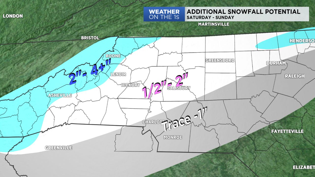
Additional accumulations from the morning snow will likely range from an inch or two for areas north of I-85 and up to about an inch south of that and in the Charlotte metro area.
By late Saturday, this storm system will begin exiting before drier air moves in, essentially cutting off what's left of the moisture.
Another shot of snow will take a dive at the mountains Saturday night into Sunday, allowing them to pick up on another inch or two.
From there, cold, but dry, high pressure will build in Sunday, allowing sunshine to return by the end of the weekend into next work week.