


Mother Nature is packing a powerful Winter punch for the High Country and the foothills. For areas along and south of I-85 it has been pretty much a cold rain with some snow at times. I'd expect a few hits of all snow for some areas, South of I-85 later tonight and early Saturday morning. Given the ground temps and the low forecast to stay a few degrees above freezing, major road issues should be a problem. Having said that, use caution when out, just in case some un-anitcipated slick spots develop.
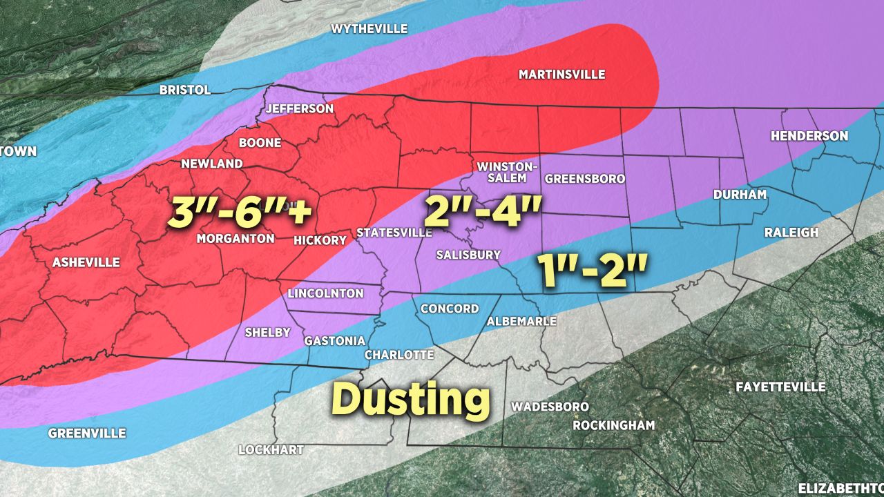
Mountain folks will continue to see snow through early Sunday morning. In total, up to 8" of snow possible with a few isolated higher amounts if the banding sets up to provide that. Caution on the mountain roads. Best to stay home and stay safe. Foothill areas may see upwards of 3-6" of snow and roads will continue to be problematic.
Piedmont areas will have this event "end" by late Saturday morning with some partly sunny or partly cloudy skies later in the afternoon. All areas that see snow or having draining water Saturday night and early Sunday will likely have problems with black ice. I'd urge extreme caution for early Sunday morning all across our area.